Variable Clouds, More Rain Ahead
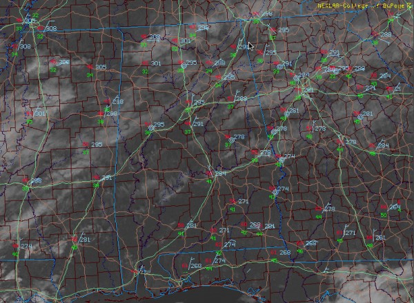
Last minute Christmas shoppers are finding pretty good going, at least weatherwise across Central Alabama on this Christmas Eve. Sky conditions are variable, ranging from low clouds and fog at Montevallo to mottled sunshine at Clanton, to fairly bright conditions at Demopolis with some high clouds giving the sky character. The cloudiness continues to slowly breakup and that trend should continue through the afternoon. But thicker clouds are massing to the west and southwest of Alabama and those clouds are spreading our way. This means increasing clouds again late this afternoon and tonight. Enjoy the sun this afternoon, it may be the last time you see it through Tuesday.
SEASONALLY COOL: Temperatures were mostly in the 40s to lower 50s across Central Alabama early this afternoon. Most folks from Tuscaloosa to Birmingham to Anniston and Gadsden will end in thge lower 50s this afternoon. Lows tonight will generally be in the lower 40s.
CHRISTMAS DAY FORECAST: By tomorrow morning, two upper level features will be of note. The upper level that has been bringing snow to the Southwest will be near El Paso. To the north, a strong upper trough will be swinging through the Upper Midwest toward Chicago. At the surface, low pressure will be over the northwestern Gulf south of Houston. The upper trough to the north will be helping a cold front to form to our northwest. The front will combine with moisture rotating around the surface low and upper low to produce scattered showers across Alabama. Highs will be in the middle 50s. A few light showers could continue into Sunday night, but 24 hour rainfall amounts will be light, generally less than a quarter of an inch. Sunday night lows will be a little cooler, around 40F, with some spots making the upper 30s.
MONDAY/TUESDAY: The models have slowed a bit with their predictions of the progression of the main system, bringing it through late Monday night now. Rain will push back into Alabama late Monday afternoon, with the bulk of the precipitation coming during the overnight hours into early Tuesday morning.
Category: Alabama's Weather


