Showers Sink Slowly South
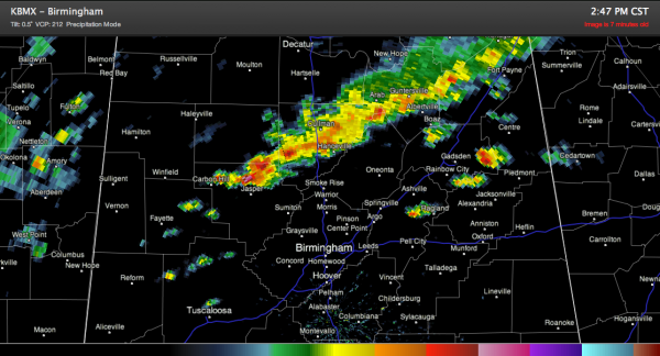
A line of heavy showers continues this afternoon from northern Walker County through Cullman County into Northeast Alabama.
At 3 p.m. the activity extends from near Carbon Hill to Good Hope to south of Arab to Fyffe. The heaviest precipitation is just north of Carbon Hill.
Another showers was in Cherokee County, while another was between Ohatchee and Ragland. Other showers were trying to organize over northern Tuscaloosa County.
Additional showers were over Northeast Mississippi pushing towards Northwest Alabama.
The entire activity is slowly sinking southeastward ahead of a southeastward moving cold front while individual cells move northeast. It will be interesting to see how far southeast that the main line makes it. For the next few hours, the activity should remain north of I-20.
Temperatures have pushed into the upper 60s and lower 70s across Central Alabama south of the shower activity where skies are partly cloudy. Over North Alabama, temperatures are still in the 50s.
Category: Alabama's Weather


