Storms Becoming Severe Over Eastern Mississippi, Possible Tornado Headed Marion County
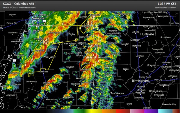
Storms finally started firing in the warm sector over northern Mississippi about two hours ago and those storms are becoming severe.
We are tracking a possible tornado in Monroe County MS that will move toward northwestern Marion County.
A hook echo is indicated west of Amory. This cell is moving northeast at 60 mph toward Smithville MS, which was devastated on April 27th. A tornado was reported on the ground at 11:20 at Trebloc.
The wind field over eastern Mississippi is very strong with 50-60 knots of bulk shear present. This will allow for very organized storms.
There is a narrow tongue of instability between 500-1000 j/kg extending over extreme western Alabama being pumped northward by a strong low level jet.
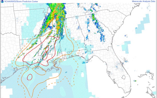
The combination has resulted in a significant tornado parameter of 1 or more over the western border counties of the state into Southwest Alabama.
Here is the STP map:
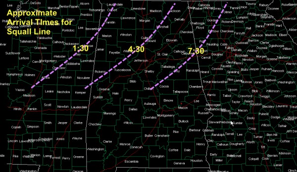
The main squall line is pushing eastward over Mississippi. Here are some approximate arrival times for this main line. There could be widespread 60-65 mph winds with this line as well as embedded small tornadoes.
Category: Alabama's Weather, Severe Weather


