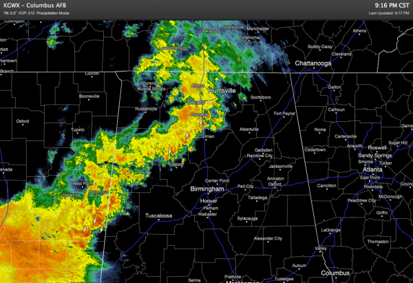
Evening Alabama Weather Update (8:30 pm)
At 8:30 this evening, a line of showers and thunderstorms extended from the Houston-Galveston area northeastward across Louisiana and Mississippi into Northwest Alabama. The most intense lightning was clustered over Southwest Mississippi
Several Flash Flood Warnings were issued this evening in the Houston-Galveston area and also in Louisiana and Mississippi.
Also, the NWS in Jackson issued a Tornado Warning for two counties in Southwest Mississippi.
The northern part of that line extended across the Northwest Alabama counties of Lamar, Marion, Franklin, Colbert and Lauderdale. The storms are not as strong in that area. This line of showers/storms was about 60 air miles west of Tuscaloosa and some 80 miles west of Birmingham
We believe these storms will weaken a bit as they continue eastward and we think there will be little threat of severe weather for our area.
But, as always, we will sip the midnight coffee and keep watch.
Category: Alabama's Weather


