Severe weather analysis 339 pm
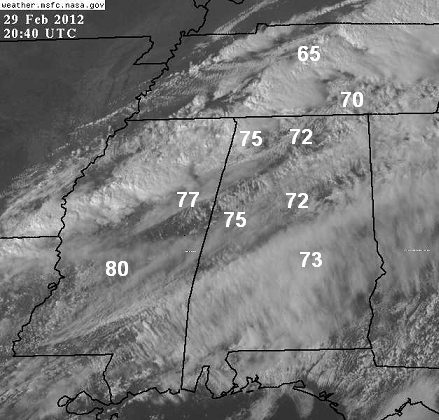
(Visible satellite with current temperatures added in)
As discussed earlier, the sun has come out at times over north and central Alabama, and as a result, temperatures have warmed into the 70s in most locations. Satellite shows some breaks in the clouds will continue this afternoon.
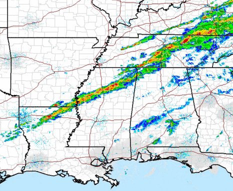
Thunderstorms currently stretch from southeastern KY, to south of Nashville, into NW Alabama, then into north MS. The storms over northern MS and NW AL have increased in intensity quite a bit in the past hour. So far, there have been no reports of damage in AL or MS.
Storms will likely continue to develop as the air is moderately unstable over central Alabama (CAPE near 1,000 J/kg), and as the cap of warm air at 6,000 feet erodes. The strongest wind shear is to our north right now, but if low-level winds back around more out of the south at sunset (a research hypothesis we are examining at UAH), the wind shear could increase in central Alabama. Right now, it looks mainly like a damaging wind threat for BHM, TCL, and ANB. But, especially if the wind shear does increase here, tornadoes are possible, and I expect a severe thunderstorm or tornado watch will probably be issued for central AL late this afternoon.
Category: Severe Weather


