Tornado About to Move Into Chilton County
We have the most dangerous storm of the day in Central Alabama now moving through Autauga County pushing into Chilton County. It will pass near Plantersville.
It passed very close to Suttle earlier.
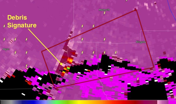
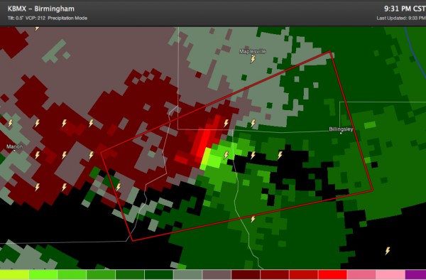
The new dual pol radar from the Shelby County Airport clearly indicates debris being lofted into the storm.
This is a clear indication that the tornado is on the ground. And it is likely a significant tornado.
There is a very strong couplet, with rotation velocities over 100 knots. There is even a debris signature on reflectivity.
This storm will move into the Verbena and Cooper area of southern Shelby County.
Call your friends in the path of this tornado and tell them to take shelter NOW!
Category: Alabama's Weather, Severe Weather


