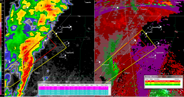
Possible Tornado Headed Toward Bentonville AR
10:14 UPDATE
The NWS Tulsa has posted a severe thunderstorm for Washington County, where Fayetteville is located.
10:08 UPDATE
This storm is going to make me eat my words about it passing north of Fayetteville. ROtation has intensified about 18 miles west southwest of Fayetteville and a TVS has popped up. The storms has turned right and is moving toward Fayetteville now. NWS Tulsa watching carefully. WOuldn’t be surprised to see tornado warning here shortly.
LATE REPORT AT 9:55
Tornado touchdown reported 8 miles west of Stilwell no on highway 51.
ORIGINAL POST
The NWS Tulsa is tracking an intense low level rotation with a couple of tornado vortex signatures about 40 miles southwest of Bentonville, AR where WalMart is headquartered.
It is moving northeast at 40-45 mph which would put it near Bentonville around 10:45.
The storm has weakened in the past few minutes, but is still dangerous.
The storm should pass just north of the Fayetteville, where the University of Arkansas is located.
Category: Headlines, Severe Weather


