

Alabama Weather Update at 8:25 am
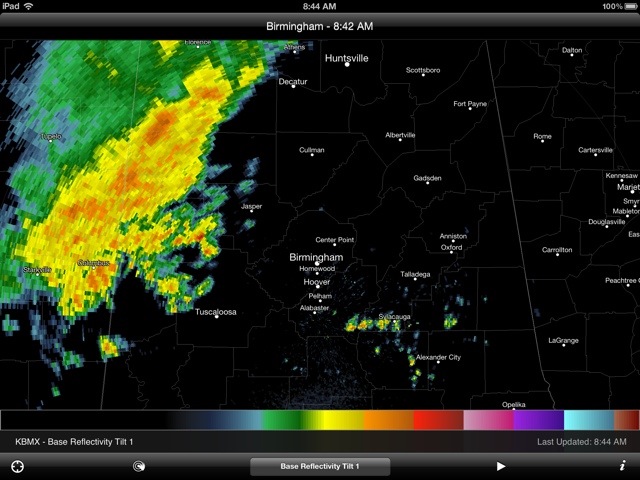
At 8:25 am, numerous showers, moderate to heavy, extend, in a broad band, from North Louisiana northeast across Mississippi into Northwest Alabama. It is pouring at this time over Northwest Alabama’s Marion, Franklin and North Lamar County, It is also pouring over several Northeast Mississippi counties.
Credit a lot of that to a stalled front now from a low in along the Texas Coast extending northeast over South Mississippi and across Central Alabama. Not to be overlooked, is another low aloft off the north coast of California. It will move eastward and this may enhance a surface low over the Northeast Gulf of Mexico by Sunday, Translation: More rain for the Southeast.
One of the weather models that tries to estimate rain amounts is showing as much as 3 to 4 inches of additional rain during the next five days across a good part of Alabama.
The Storm Prediction Center has posted a “slight risk” for severe weather for North Georgia and South Carolina.
Back home in Alabama, we believe that our most pleasant weather in the near future will be Wednesday night, Thursday, Friday and Sunday.
We shall see.
Will try to post some sort of a rain scorecard (progress report) later this morning. Some serious flash flooding in South Texas in the last 24 hours…as much as eight inches in places. It was a hot 91 in Albany, N.Y., yesterday. Sometimes the weather gets out of whack over a wide area!
But life goes on!
Category: Alabama's Weather
About the Author (Author Profile)
Subscribe
If you enjoyed this article, subscribe to receive more just like it.


