Shelby County Storms Producing Hail, Lightning
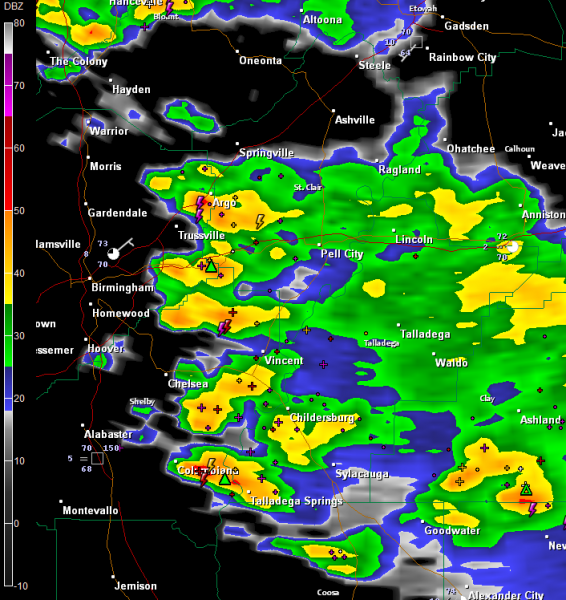
The thunderstorms moving into Shelby County from an odd northeasterly heading are producing lots of lightning and thunder and even some small hail this morning.
Pea sized hail was reported at Leeds at 8:15 a.m.
The storms are lined up from near Argo to Moody to near Chelsea, Columbiana and Talladega Springs.
Small hail is still indicated in that core southwest of Leeds and just southeast of Columbiana. Nickel sized hail was reported at 8:29 at highway 145 and county road 28 east of Columbiana. That lines up nicely with the radar.
They are pushing south southwestward.
FOR THE TRACK
The Speedway is that small cross just southeast of Lincoln on the radar image. Light to moderate rain continues there now and will for the next hour or so. It should begin to taper off after that. There is a risk of a shower during the race, but this morning’s storms have actually done us a favor as the boundary that caused them has pushed southwest of the track.
Category: Alabama's Weather, Severe Weather


