Update 10 pm
Looking at area radars (BMX, GWX, DGX, and SHV), while the heaviest and most widespread precipitation is to our north, in Tennessee and Kentucky, snow is increasing some in central Mississippi and even parts of northern Louisiana. Recall that warm air moving in and upper-level disturbances cause precipitation, and cold air moving in suppresses precipitation.
Right now, even with a large upper-level disturbance, cold air is moving into Alabama, while it was basically already in place in MS and TN earlier. This may be why the precipitation is so much lighter here.
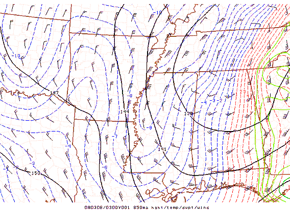
Further west, where the colder air is, precipitation is able to fall more efficiently, since the cold air is not having to move in. This may occur over central Alabama later tonight, as the cold air settles in.
Category: Uncategorized
About the Author (Author Profile)
Subscribe
If you enjoyed this article, subscribe to receive more just like it.


