Waiting on the Next Package
We’re about an hour from the next advisory package and updated forecast track.
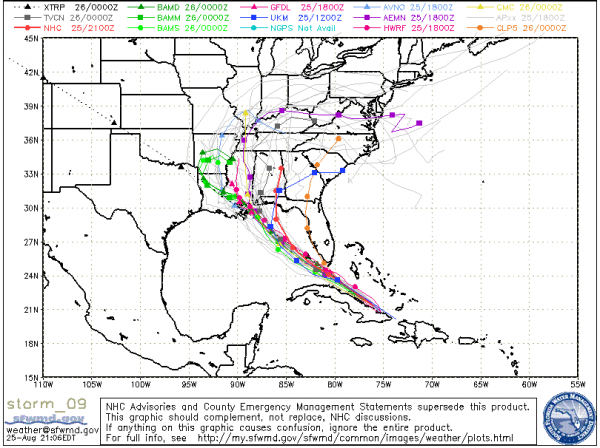
It will be interesting to see what the forecasters at the National Hurricane Center do, since there has been a significant westward shift in the model forecasts late today. Here is your latest plate of spaghetti models:
The storm has been very disorganized all afternoon and evening, but thunderstorms are really starting to blow up now over eastern Cuba and near the center off the north coast of the island nation.
The latest recon fix was at 6:23. Central pressure was 997 millibars. Max flight level winds were 53 mph in the eastern quadrant. That translates to about 45 mph, which seems logical given the disorganized nature of the storm on satellite. Will be interesting to see if Isaac can overcome this disorganization. I think it will.
LATE BULLETIN
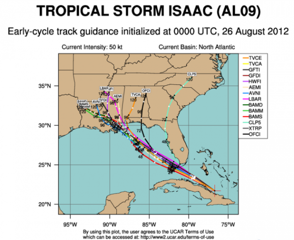
The early guidance based on the 0z model runs is pointing to New Orleans…
Waiting for the package…
Category: Tropical


