Isaac Getting Better Organized, Still Has Not Strengthened
The 1 p.m. advisory is out and Isaac still has not strengthened. But it is getting better organized it appears.
FAST FACTS AT 1 PM
———————————————-
LOCATION…23.9N 81.5W
ABOUT 50 MI…85 KM SSE OF KEY WEST FLORIDA
ABOUT 75 MI…120 KM NE OF HAVANA CUBA
MAXIMUM SUSTAINED WINDS…60 MPH…95 KM/H
PRESENT MOVEMENT…WNW OR 300 DEGREES AT 18 MPH…30 KM/H
MINIMUM CENTRAL PRESSURE…994 MB…29.35 INCHES
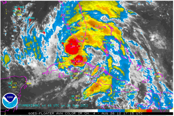
On satellite, it appears that thunderstorms are growing around the center on the northwest and southeast sides.
At 12:30, the Key West radar locates it about 50 miles SSE of Key west. It appears that the center is going through a reorganization process. You see lots of smaller centers develop, then rotate around a larger circle.
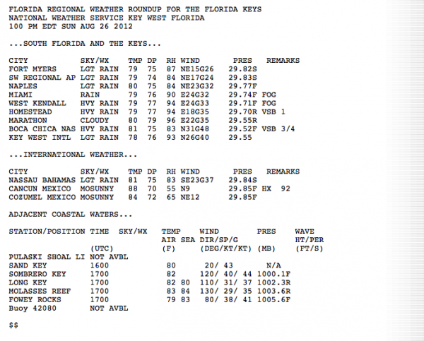
It is rainy and windy in the keys. Winds gusted to 55 mph at Virginia Key a short time ago. Here are the observations from South Florida:
But a short time ago, a 63 mph wind gust was observed at the Key West station.
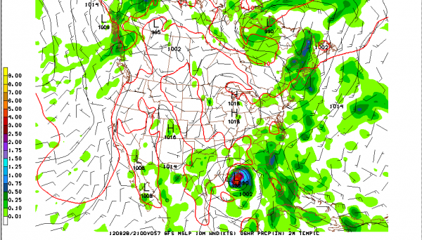
The 12z run of the GFS is in and it clearly takes it to the Southeast Louisiana coast south of New Orleans Tuesday afternoon, then tracks it westward along the coast, moving into eastern Texas on Thursday then up through the drought belt of Missouri, Arkansas, Illinois, Indiana and Ohio later in the week.
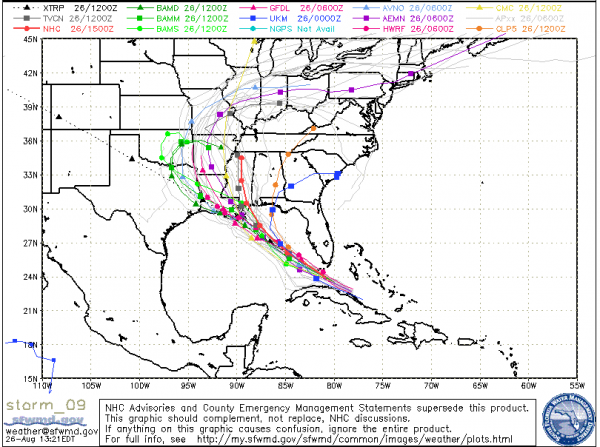
The guidance is overall in favor of a westward track that would impact Louisiana now.
New Orleans Mayor will hold press conference at 2:45. We know that it takes over 2 days to evacuate New Orleans, so that is a major decision.
The official NHC track forecast may be shifted further westward later today. Hurricane warnings may be posted for parts of the coast later today.
Obviously, a westward track would mean much less impact on Central Alabama weather.
The reason for the westward change in the track is that an upper level trough that we thought was going to turn the hurricane north is expected to remain tantalizingly out of reach as the hurricane continues northwestward. But we can’t let our guard down anywhere in the hurricane watch area. That watch area now includes the Louisiana coast east of Morgan City (including New Orleans), the Mississippi and Alabama coasts and the NW Florida coast to Indian Pass.
Category: Tropical


