Almost a Hurricane
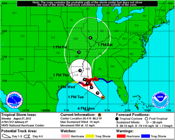
The new package is out on Isaac. Stops just short of upgrading to hurricane.
Pressure down to 981 millibars. Winds on the advisory at 70 mph. Movement is NW at 12.
The plane found a widespread area of 60+ knot flight level winds all along their flight path from west to east through that major convective mass south of the center.
The storm still looks like it is still being sheared and there is dry air wrapping into it on the eastern side. This is keeping it from really strengthening rapidly.
The forecast does make it a category two with top winds of 100 mph right before landfall.
The official track was shifted ever so slightly to the left with the skinny black line we’re not supposed to pay attention to running just west of New Orleans now.
FROM TWITTER:
Tweet from NWS Mobile: Large swells from TS #Isaac with 11 second periods set to impact the area beaches tonight with breakers up to 8 feet.
Amtrak stopping City of New Orleans at Memphis.
Alabama Power: We’re bringing in 300 line-crew workers from across the Southeast, in case #Isaac brings trouble to Alabama:
Category: Tropical


