Good News
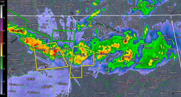
Our storms are weakening as they cross the state line from Mississippi.
Doppler radar indicated velocities have decreased and the severe threat will continue to diminish.
Can’t rule out a few damaging wind reports, but hopefully the storms will continue to go down hill. They will continue to have lots of torrential rains and lightning in addition to the gusty winds.
The NWS has issued a significant weather advisory for eastern Marion, western Walker, Lamar and Fayette Counties. The warning for Marion and Lamar counties will be allowed to expire.
The tornado watch has been canceled for North Alabama. The tornado watch continues for West Central Alabama until 11 p.m. but the severe thunderstorm watch for the rest of Central Alabama has just been canceled.
Category: Alabama's Weather, Severe Weather


