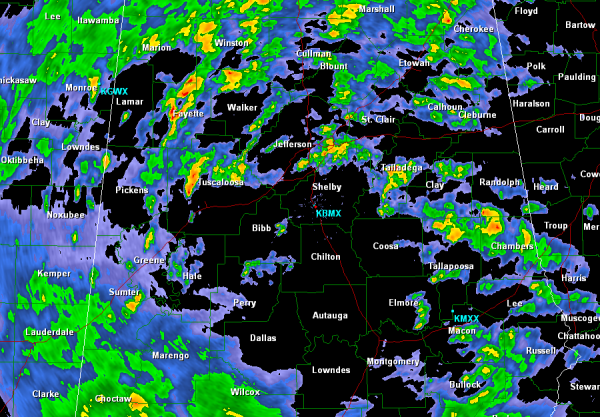
Afternoon Radar Check…
This afternoon numerous showers and thunderstorms are working their way north and east across the state. A soaker of a system is working across the Southeast today and tomorrow. Some areas of the next 24 hours could receive in access of 3 inches of rain, with most areas between 2-3 inches.
Looking at the radar shows bands of heavier showers along the I-20 corridor off to the north or Birmingham Metro, but there is plenty more rain off to our south and west. Parts of the Tennessee Valley are under a flash flood watch that extends as far south as Cullman County. Already a Lauderdale and Colbert Counties in northwest Alabama are under flash flood warnings. We will be watching for the rain to continue and a chance for some isolated severe thunderstorms. The main threat from this system is flash flooding but their is an increase chance of small spin-up tornadoes with this event. They will be short-lived and rain wrapped so do not expect to see them. Just east of Birmingham and across east Alabama, the Storm Prediction Center has an area outlined in a slight risk for severe weather for the rest of today.
It is going to be a wet evening and night across the state. Should be great sleeping weather.
Category: Alabama's Weather


