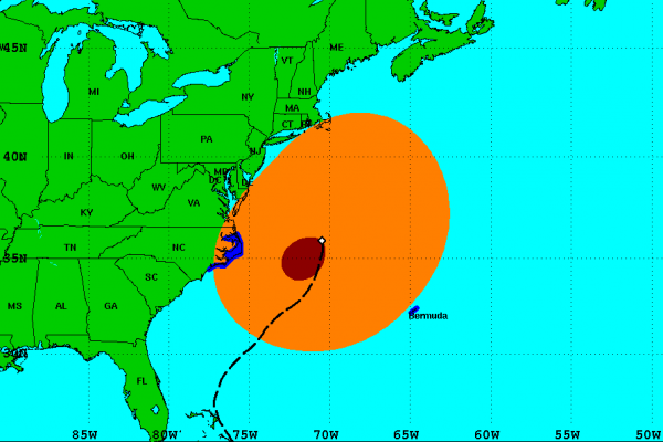
Sandy’s Wind Field
Sandy is a very large storm system and its impacts will be felt by millions of people for days. From North Carolina to New England, tropical storm winds are beginning to impact the shoreline.
The wind field with Sandy is one of the largest I can remember for an Atlantic Storm. Looking at the surface winds, the orange represents the expanse of the tropical storm winds, that is sustained at 39mph or greater. The winds extend out from the center of Sandy more than 500 miles. The red represents the hurricane force winds. They are a bit more concentrated and are staying near the center. With such a large and strong wind field is no wonder that so many people are expected to lose power. Along with the extent of the wind field the duration of the winds will be just a problematic. Days and days of high winds with saturated grounds could produce historical amounts of tree and power line damage.
The system has started to make the westward turn that has been forecasted for days. Sandy is currently moving to the NNW at 20 mph. That puts it on the New Jersey Coast sometime in the early morning hours of Tuesday.
The persistent winds will continue to pile the water up along the shore and will produce tremendous coastal flooding.
Category: Tropical


