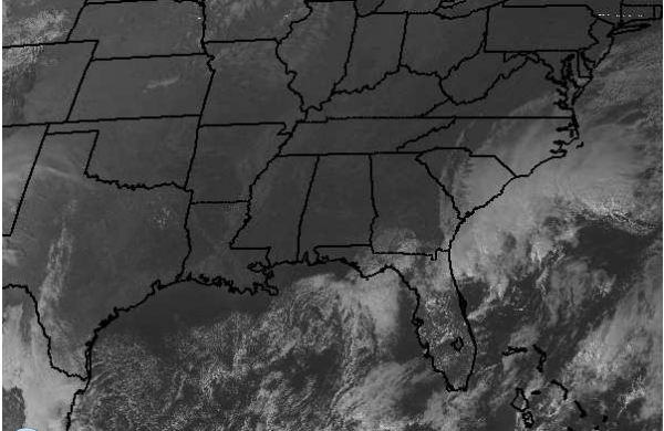
Afternoon Satellite Check
Nothing but severe clear across Alabama and much of the Southeast this afternoon. High pressure remains in control of the eastern half of the United States. The area of high pressure is producing a lot of subsidence, and that is why there are so few clouds across our part of the country. We do see some clouds across the eastern Carolinas and the Florida Peninsula. This activity is associated with a low pressure trough off the Southeast coast; that has some thunderstorm activity with it off shore. These clouds have been working slowly westward through out the day. Some of the clouds could be working there way into Alabama overnight, especially in the southeastern counties. If that happens, overnight lows could stay up a bit as the clouds could act like a blanket for some areas trapping in heat .
For areas that do not see any cloud cover, once the sun goes down temperatures will fall quickly. With calm winds and clear skies radiational cooling will allow for temperatures to fall back down into the 30s overnight. Average low around 38 for central Alabama. Some areas could be much cooler, and do not be surprised to see some widespread patchy frost again in the morning.
Category: Alabama's Weather


