On the Weather Maps
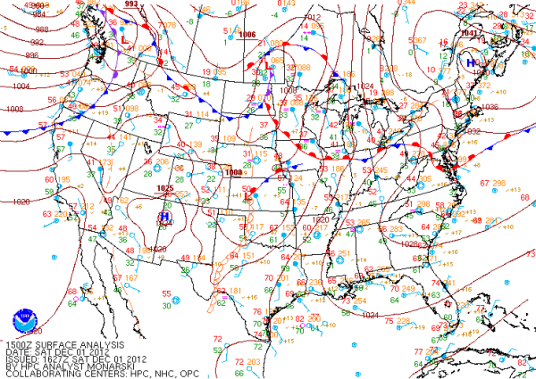
Much of the country has been under very calm conditions most of the week. An early week cold front brought an area of high pressure that settled in across the eastern half of the country and with it the cold air we had midweek. That high pressure has moved off the Atlantic Coast and is allowing moisture to return over the Southeast. Along with more moisture our temperatures have increased too. Very mild conditions look to hang around for several days. The strong storm system moving onto the West Coast will not affect us until Tuesday evening.
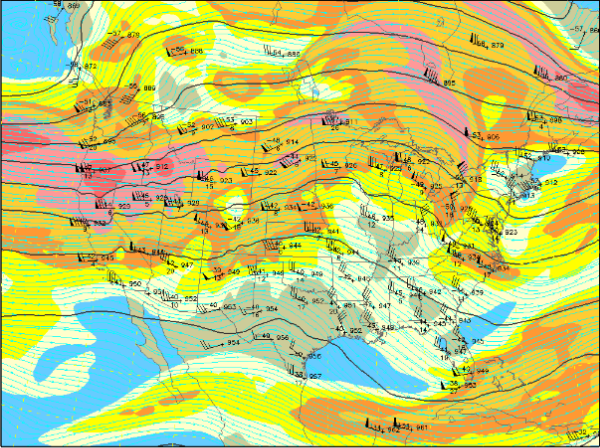
The main reason we have milder weather is that we have zonal flow across the U.S. Looking at the upper level 300mb map below, you will notice that the winds across the country are blowing mostly in a west to east direction. We have a little bit of the leftover trough along the East Coast that brought our colder weather this week. It will continue to move off the coast over the next day or so. The 300mb jet is really keeping much of the cold air bottled up in Canada and Alaska. Until we see some major dips and troughs in the jet stream, where the winds will be blowing from north to south, the cold air will not be making its way south. The forecast runs of the models, do not show any major cold air intrusion over the next seven days.
Category: Alabama's Weather


