Christmas Weather Woes
With so many people traveling and being out of pocket at Christmas, we encourage you to “stay in the loop” with weather information as we get closer since we have a potential high impact weather event for much of the Deep South. A deep surface low will move from near Jackson, MS to Knoxville, TN, with potential for severe weather southeast of the low, and with snow to the northwest over the colder air.
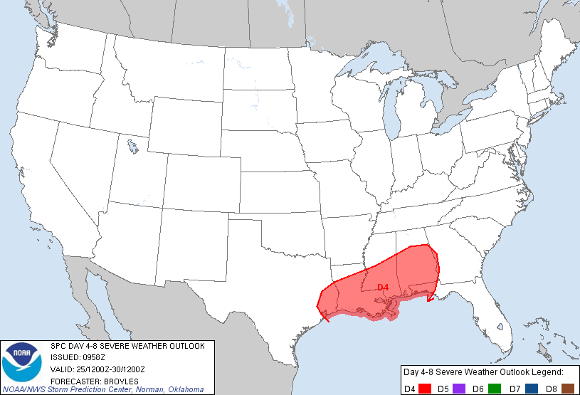
SEVERE WEATHER: Below is the SPC “Day Four” convective outlook, which is for Tuesday and Tuesday night…
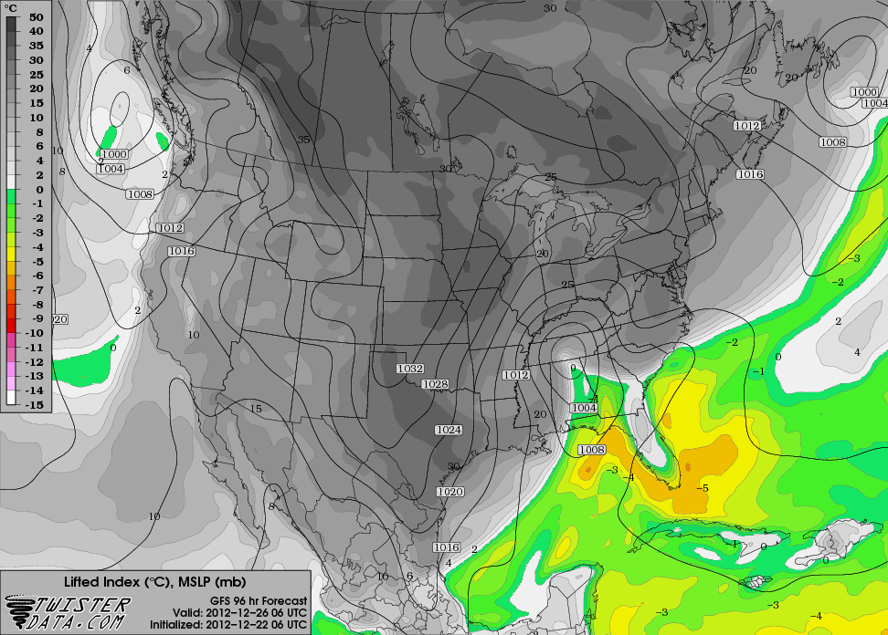
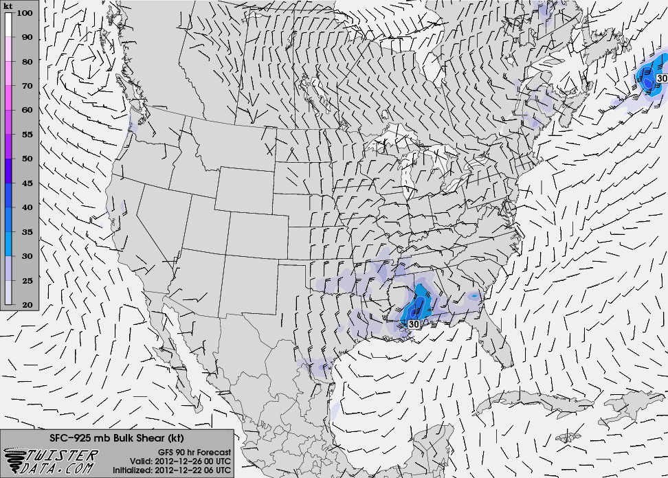
There will be sufficient instability and shear in the warm sector of the storm for severe weather as you can see from the maps below…
At this early stage of the game, it looks like the primary risk of severe weather in Alabama will come from about 6:00 p.m. Tuesday until 3:00 a.m. Wednesday, with the main risk in Alabama south of I-59. As usual in winter, the primary limiting factor will be the amount of available surface based instability, but we can’t rule out a few isolated tornadoes based on the projected helicity values. Damaging straight line winds will be possible as well with the stronger storms.
Understand the placement of the severe weather risk can, and probably will change as we get closer. Stay tuned.
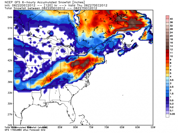
SNOW: A nice snow event is setting up Christmas Day for parts of Arkansas, Southeast Missouri, Northwest Tennessee, and parts of Kentucky in the cold sector northwest of the surface low track. Below is the GFS snow depth projection for the system…
Wednesday in Alabama promises to be a windy and sharply colder day with falling temperatures. No doubt there could be a little light snow in the back side of the departing storm system over the Tennessee Valley of extreme North Alabama, but for now we figure the best chance of accumulating snow will be north of our state.
So… some fun days ahead in the weather office… our greatest concern here is the severe weather threat, especially for the southern half of Alabama. Scroll down for Brian’s Saturday morning discussion and take a look at the Weather Xtreme video for more details…
Category: Alabama's Weather
About the Author (Author Profile)
James Spann is one of the most recognized and trusted television meteorologists in the industry. He holds the AMS CCM designation and television seals from the AMS and NWA. He is a past winner of the Broadcast Meteorologist of the Year from both professional organizations.Subscribe
If you enjoyed this article, subscribe to receive more just like it.


