Significant Severe Weather Risk Christmas Afternoon/Night
Brian will be along in a bit with his discussion and a new Weather Xtreme video.
Unfortunately parameters are still in place for the potential for a major severe weather threat for the Deep South Tuesday into Tuesday night. If you are reading this, I am not worried about you and your family being aware of the threat, but be sure and pass this on to your friends, neighbors, and relatives. We have a much harder time reaching the masses at Christmas time, but this is something everybody needs know. This isn’t to alarm anyone, but simply to let you know you need to be close to a source of severe weather information.
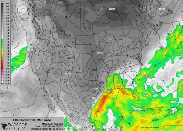
THE SETUP: A deep surface low will run from near Shreveport to Nashville Christmas Day. This keeps Alabama in the warm sector of the storm system, and all models show sufficient instability and shear/helicity for severe weather… below is the projected instability at 6pm CST Tuesday. The green is where lifted index goes below zero, or where there is surface based instability.
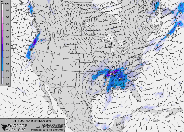
Bulk shear values remain impressive southeast of the surface low…
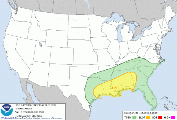
Below is the SPC “Day Three” convective outlook…
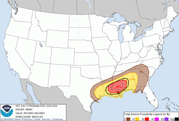
The “hatched area” below is where significant severe weather is possible, roughly from Tuscaloosa southwest to near Lake Charles. SPC defines significant severe weather as F2 or greater tornadoes, damaging winds with speeds greater than 65 knots, or large hail 2″ or greater in diameter.
THREATS: We will have the dual threat of severe storms with damaging winds, and tornadoes with this system. If discrete cells can form ahead of the main squall line, some of them could rotate and produce a tornado. A strong tornado is possible considering the dynamics.
PLACEMENT: The greatest risk of severe weather in Alabama will be along and south of U.S. 278… Hamilton to Cullman to Gadsden… but the latest model data suggests a few strong to severe storms are possible up to the Tennessee border, but the limited instability there suggests the risk could be smaller. Bottom line is that all of Alabama will need to be ready for this.
TIMING: Keep in mind showers are possible as early as tonight as moisture begins to return and a warm front organizes to the south. We will have potential for showers tomorrow and tomorrow night as well, but as the warm front lifts north of here and we get into the unstable air, the primary risk of severe weather will come from 2:00 p.m. Tuesday through 2:00 a.m. Wednesday.
CALL TO ACTION: This is a very challenging event due to so many people traveling. Bottom line is this… everybody in Alabama needs to be sure they have a good way of hearing severe weather and tornado warnings, and that should NEVER be an outdoor siren. Those things are good only for reaching a handful of people outdoors. Have a good, working NOAA Weather Radio receiver in your home, properly programmed, with fresh batteries in case power goes out. On top of that, if you have a smart phone, have a good warning app installed and running, and of course, properly programmed.
For iPhone, a great choice is MyWarn. For Android phones, iMap WeatherRadio is fantastic; there is also an iPhone version. You can watch our live streaming coverage on both, and you receive the warnings only if you are in a tornado warning polygon (remember, warnings are polygon based, not county based).
And, be sure you review your plan of action. If you live in a mobile home and you are in a tornado warning polygon, you have to leave and go to shelter. In site built homes, be in a small room (hall, closet, bathroom) on the lowest floor (basement if you have one), away from windows, and near the center of the house. Be sure everybody in your home, including visitors, understands this plan.
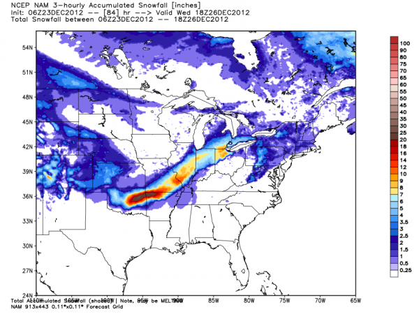
SNOW TO THE NORTHWEST: For those of you traveling, a big snow is likely in the cold sector of this storm in the broad area from Fort Smith, Arkansas to Indianapolis…
Here in Alabama Wednesday will be cold and raw; we probably won’t get out of the 30s and snow flurries are possible over the northern third of the state, but accumulation isn’t expected.
Let’s hope we escape with no major problems, but we must be prepared. I hope you and your family have a very merry and meaningful Christmas this year, but we must be safe. Stay tuned to the blog for updates as the event gets closer.
Category: Alabama's Weather, Severe Weather
About the Author (Author Profile)
James Spann is one of the most recognized and trusted television meteorologists in the industry. He holds the AMS CCM designation and television seals from the AMS and NWA. He is a past winner of the Broadcast Meteorologist of the Year from both professional organizations.Subscribe
If you enjoyed this article, subscribe to receive more just like it.


