A Cloudy Sunday
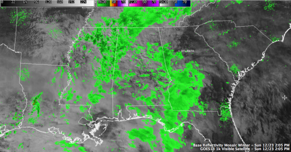
Clouds started gathering overnight and have been thickening all day across Central Alabama. Temperatures are in the 50s. Showers started breaking out over Mississippi this morning and spread into parts of West Central Alabama this morning. Much of the precipitation was not reaching the ground early on, but that will change as the atmosphere moistens.
Rain chances will go up overnight as a warm front comes northward in response to a developing surface low over Northeast Texas. There could be a little thunder involved toward sunrise, but no real storminess is expected with this first system. Rainfall amounts should average around one half inch by mid morning tomorrow. Overnight lows will drop into the upper 40s.
Showers and some embedded thunder will be ongoing in the morning ahead of the cold front. The showers should be southeast of I-59 by mid-morning and out of East Alabama by earlier afternoon, although there could be a few lingering showers for a few hours behind the front. There should be a few peeks of sunshine during the late afternoon, especially over western sections. The clearing will be brief, however, as clouds will re-thicken again overnight. Temperatures will be mild for Christmas Eve, dropping only to 50F-52F.
SEVERE WEATHER THREAT: By Tuesday morning, a very strong upper level disturbance will be swinging across Texas. This upper trough will become oriented in a northwest to southeast manner, which is not a good thing. We call it negatively tilted, and it can really enhance the energy available for severe weather.
The trough will power up a rapidly deepening surface low over the Piney Woods of eastern Texas Tuesday morning. The surface low will move quickly northeast to a position near Columbus, Mississippi by Tuesday evening. A warm front will lift across Southwest and into Central Alabama late Tuesday afternoon and evening in response to this vortex.
This may be the focus for severe weather Tuesday afternoon and evening as it lifts northward. With strong wind fields aloft and the convergence at the ground, these storms could produce damaging winds and even tornadoes. The only question mark is meager instability. But up to 750 joules of CAPE is expected across much of the southern three quarters of Alabama Tuesday afternoon and evening. This is plenty sufficient to produce significant severe weather.
The SPC maintains a 30% chance of severe weather within 25 miles of points south of the Tennessee Valley. This is on the high end of the slight risk category and wouldn’t take much to get into the moderate risk category. They SPC warns that supercell thunderstorms could develop in the warm sector over southern Mississippi into South Central and Southwest Alabama late Tuesday. They even mention the possibility of strong tornadoes if this situation comes together.
LATE MODEL NOTE: Brian was commenting on the amazing consistency between our two favorite long range models in their handling of this system. The European is now in, and is on the same track as previous runs. It might be a little slower and a little further north with the warm front. This continues to lend more and more credence to the severe weather threat.
PAY ATTENTION TO LATER FORECASTS: Since many folks will be pre-occupied with holiday plans and away from the weather grid, it is important to remind friends and family to keep an eye on the weather situation. It will be important to have your source of weather alerts close at hand and to review your severe weather safety plan for Tuesday and Tuesday night.
HAVING SAID ALL THAT: Many people are asking if this will be like April 27th. We certainly don’t think so. This is a winter event with low instability and high shear, unlike the generational outbreak of April 27, 2011 that generally only comes along every 40 years in Alabama. But all it takes is one tornado coming down your street for it to be YOUR April 27th. Take the situation seriously, but don’t panic. Just be prepared.
Category: Alabama's Weather, Severe Weather
About the Author (Author Profile)
Bill Murray is the President of The Weather Factory. He is the site's official weather historian and a weekend forecaster. He also anchors the site's severe weather coverage. Bill Murray is the proud holder of National Weather Association Digital Seal #0001 @wxhistorianSubscribe
If you enjoyed this article, subscribe to receive more just like it.


