Spann Will Stream Starting at 2 p.m.
Here is a link to the severe weather live stream which will start at 2 p.m.
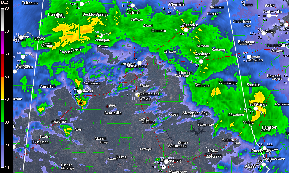
We have been tracking a small thunderstorm move along the warm front in Hale County near Moundville. The storm actually exhibited signs of rotation and had a wall cloud.
The main severe weather is still at least a couple of hours away for us here in Alabama. The warm sector is moving northward behind the retreating warm front. We will be watching to see how far north it gets.
The line of intense storms is now into western Mississippi. The warm front is lying along I-20, and where the storms are intersecting the front is especially worrisome. Severe thunderstorm warnings blanket the countryside ahead of the line. There are four tornado warnings, one for areas around Brookhaven MS, one for areas near Jackson, Louisiana, another for areas around Thibodeaux and another for areas around Simmesport.
The new Day One severe weather outlook is out. The SPC has opted not to go high risk, which is a good call. The slight risk northward and eastward extent is unchanged. The western edges of the moderate risk and slight risk areas have been trimmed to take into account the eastward progression of the line of storms. The moderate risk area was pushed just a little more to the north to encompass Jackson MS.
Category: Alabama's Weather, Severe Weather
About the Author (Author Profile)
Bill Murray is the President of The Weather Factory. He is the site's official weather historian and a weekend forecaster. He also anchors the site's severe weather coverage. Bill Murray is the proud holder of National Weather Association Digital Seal #0001 @wxhistorianSubscribe
If you enjoyed this article, subscribe to receive more just like it.


