Afternoon Weather Discussion
Looks like I won’t have time to put together a Weather Xtreme video this afternoon… but here are some notes on what we expect for the rest of the day…
*No change in our thinking on the timing. The main window for severe storms around here will be from about 12:00 until 7:00 p.m. Storms will be scattered initially ahead of the squall line, and these discreet cells are the ones to watch.
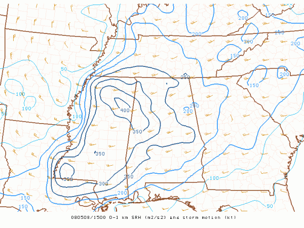
*The highest 0 to 1 km SRH (storm relative helicity) values are over West-Central Alabama:
This is where the greatest threat of isolated tornadoes will be during the early afternoon hours; that maximum SRH will move over to East Alabama later in the afternoon.
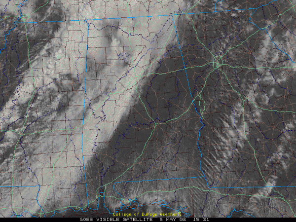
*Instability values are rising now, approaching 1,000 j/kg here at late morning. Looks like the surface based CAPE values will peak around 2,000 j/kg this afternoon, certainly sufficient for severe storms. Visible satellite images show thin spots in the overcast over Northwest Alabama:
*I expect SPC to issue a tornado watch for most of North-Central Alabama within the next hour based on all of this. Stay tuned to the blog for updates, and of course, we will go on our live stream and ABC 33/40 TV if any county in our market happens to go under a tornado warning.
Category: Uncategorized


