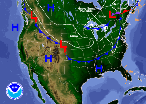
Here Comes the Cold
A quick look at the forecast for tomorrow, a cold front on the leading edge of the bitterly cold arctic air will be diving south across the eastern half of the U.S. This is a dry front and we are not expecting it to produce any type of precip. May see a few extra clouds along the front with the added uplift, but this front should pass through nearly unnoticed. Soon after the front passes, temperature will begin to fall and with the source region of this air mass from the arctic, temperatures will be cold. Monday and Tuesday will both start off in the low 20s and may be seeing some teens for overnight lows.
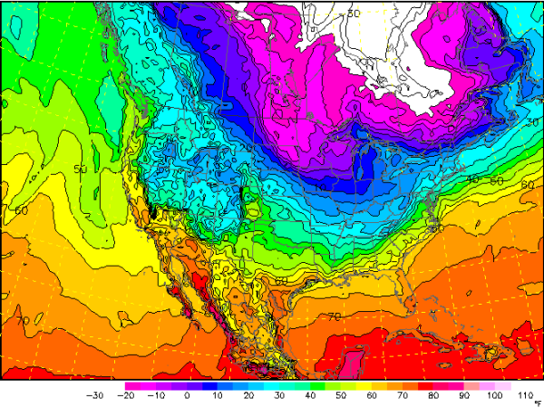
We could see some of the coldest weather we have seen this winter. It will be cold here to start the week with afternoon highs in the 40s. Luckily we will miss out on the terribly cold air that will invade the Midwest, where some ares will not get above zero. Forecast temperature map for Monday afternoon shows that temps could stay in the lower teens below zero.
For the Southeast, it would appear this should be a quick shot of cold air with temperatures moderating as we head through out the week. It needs to be said, that often when the northwest flow bringing cold air into North America starts, it is a series of waves or impulses. Impulses that each time they occur bring more and more cold air with them. The models continue to suggest that January could be ending with widespread cold air east of the Rockies.
Category: Alabama's Weather
About the Author (Author Profile)
Macon, Georgia Television Chief Meteorologist, Birmingham native, and long time Contributor on AlabamaWX. Stormchaser. I did not choose Weather, it chose Me. College Football Fanatic. @Ryan_StinnetSubscribe
If you enjoyed this article, subscribe to receive more just like it.


