

Heavy Rain/Gusty Winds in Birmingham Metro
Storms are now moving into the Birmingham area right now with torrential rains and gusty winds.
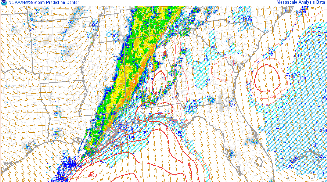
These storms are part of the main line that has slowed over the past couple of hours. It now extends from west of Gadsden to near Oneonta to downtown Birmingham to Centreville to east of Greensboro to Linden.
West of this line, dew points quickly drop into the 50s and the severe weather threat ends.
The dewpoint has already dropped to 56F on the Skycam in downtown Birmingham.
Along the line, there is still the threat of embedded features that can produce damaging winds or even potentially tornadoes. Right now there are no warnings along the line.
The main threat is ahead of the squall line, in any storms that form out by themselves. Conditions will become more favorable for severe weather as temperatures rise in areas southeast of the line.
We have that right now in southern Talladega County where a tornado warning is in effect. That circulation has weakened and the warning may be canceled as the storm moves out of the polygon well before the expiration time.
FLOODING ISSUES
We could see some flooding issues that have seen very heavy rain. Parts of Hale County have likely seen 3-4 inches of rain. A wide area has picked up 1-3 inches of rain from Walker through western Jefferson, Tuscaloosa, Hale, Greene, Marengo and Sumter Counties.
Category: Alabama's Weather, Severe Weather
About the Author (Author Profile)
Bill Murray is the President of The Weather Factory. He is the site's official weather historian and a weekend forecaster. He also anchors the site's severe weather coverage. Bill Murray is the proud holder of National Weather Association Digital Seal #0001 @wxhistorianSubscribe
If you enjoyed this article, subscribe to receive more just like it.


