Late Night Look
Quick late night check on Central Alabama weather…
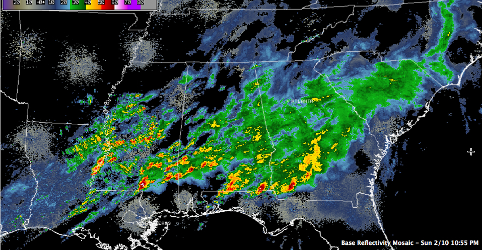
No severe weather overnight across North Central Alabama. All of the activity has pushed into South Alabama.
But showers and storms are increasing in coverage and intensity tonight over southern Mississippi south of I-20.
A large severe thunderstorm is unfortunately approaching Hattiesburg, which was hard hit by a tornado late this afternoon.
Other storms are building back near the Mississippi River.
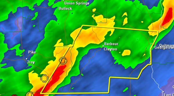
In Alabama, showers and storms are over the southern third of the state.
The Mississippi storms will impact South and South Central Alabama later tonight.
Rainfall amounts are already in the 2-3 inch range across a good bit of Central Alabama and there are some 3-5 inch amounts over southeastern sections. Additional rains will likely cause flooding and flash flood watches are in effect through 6 p.m. tomorrow night.
We will monitor for additional severe threats overnight and will have updates as necessary.
Category: Alabama's Weather, Severe Weather
About the Author (Author Profile)
Bill Murray is the President of The Weather Factory. He is the site's official weather historian and a weekend forecaster. He also anchors the site's severe weather coverage. Bill Murray is the proud holder of National Weather Association Digital Seal #0001 @wxhistorianSubscribe
If you enjoyed this article, subscribe to receive more just like it.


