

77 mph Wind Gust at CBM
Our line of thunderstorms is moving rapidly to the east across Northwest and West central Alabama this afternoon.
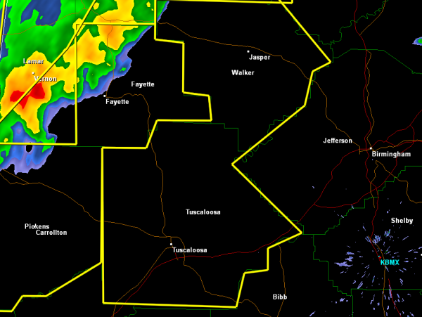
At 2:30, it extends from the Huntsville/Decatur area southwestward across northwestern Winston County, then across eastern Marion County east of Hamilton then into Lamar County and to near Columbus MS.
New severe thunderstorm warnings for Tuscaloosa and Walker Counties to go with the others you see on the map.
It is moving east at over 50 mph.
REPORTS
…Trees and power lines down in Bear Creek in Marion County at 2:20.
…Several reports of large hail, up to the size of silver dollars.
…Winds gusted to 77 mph at the Columbus AFB
…Winds estimated to 70 mph at the EOC in Sulligent in Lamar County
…Trees and power lines down at Sulligent and Vernon in Lamar County.
…Hail covering interstate on I-65 at Elkmont with traffic stopped
Winds to 70 mph are possible with the stronger storms, especially across Lamar and Fayette Counties. Large hail is likely to the size of golfballs. And there is plenty of lightning and brief torrential rains as well.
Can’t rule out an isolated tornado as well. The storm moving across Winston County near Double Springs shows the best structure right now for a possible tornado.
Category: Alabama's Weather
About the Author (Author Profile)
Bill Murray is the President of The Weather Factory. He is the site's official weather historian and a weekend forecaster. He also anchors the site's severe weather coverage. Bill Murray is the proud holder of National Weather Association Digital Seal #0001 @wxhistorianSubscribe
If you enjoyed this article, subscribe to receive more just like it.


