

Showers and Storms Building For Overnight
Click to enlarge
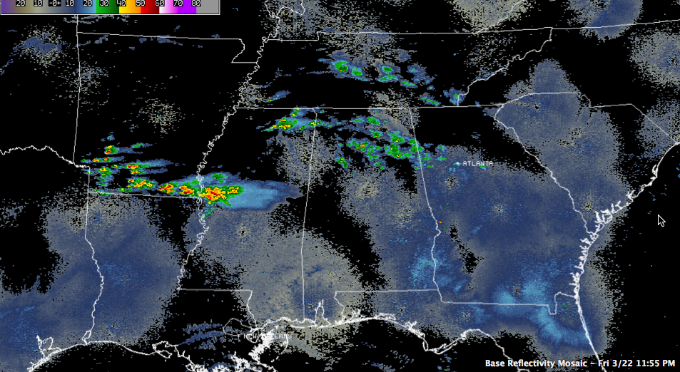
Regional radars tonight show showers and storms building over northern Alabama and Mississippi early this morning ahead of an upper level disturbance crossing the Mississippi River.
Across Central Alabama, skies are mostly cloudy and temperatures are in the middle 40s for the most part.
A surface low is north of Houston early on this Saturday. This surface low will try to push a warm front up into Louisiana, southern Mississippi and Northwest Florida.
The front and this disturbance will combine to produce widespread showers and elevated storms overnight. This activity will spread east and east southeast through the early morning hours.
The storms should not be strong, but they will be loud. We can rule out a severe storm through the morning hours, however. But the better chance for severe weather will be during the afternoon and especially during the overnight, with another stronger surface low moving across the state from Mississippi. Ahead of the low, a stronger surface warm front will be pushing northward. Storms will be severe along the front late Saturday afternoon and evening up to near the US-278 corridor.
The best chance will be south of a line from Livingston to Brent to Clanton to Phenix City, between 6 p.m. tonight and 6 a.m. Sunday.
Damaging winds will be the main threat, but there will be a few tornadoes possibly as well. Hail will be widsepread as well.
Category: Alabama's Weather, Severe Weather
About the Author (Author Profile)
Bill Murray is the President of The Weather Factory. He is the site's official weather historian and a weekend forecaster. He also anchors the site's severe weather coverage. Bill Murray is the proud holder of National Weather Association Digital Seal #0001 @wxhistorianSubscribe
If you enjoyed this article, subscribe to receive more just like it.


