Strong Non-Severe Storms this Morning
It has already been a bumpy ride for many areas across north central Alabama this morning. Storms developed overnight and have moved into the area. These storms have been producing frequent lightning, torrential rainfall, gusty winds and even some small hail this morning. As of right now, even though these storms are intense, none of them are currently severe. Most intense activity is rough along I-20 from the Georgia state line back into Birmingham and farther west towards Jasper, Fayette, and Tuscaloosa. Lamar County is under a flash flood warning until 8:30 this morning.
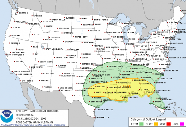
More storms will develop later today and there will be chance of widespread severe weather the SPC has much of the Southeast and the state of Alabama outlined in a risk for severe weather today. The main threat will be large hail and damaging winds, but an isolated tornado or two cannot be ruled out. The heaviest activity should impact our area into the overnight hours. The extent of the severe weather today will depend on how far inland a warm front lifting north from the coast makes it.
Category: Alabama's Weather, Severe Weather


