

Tornado Warning Winston County until 3:45PM

High probability of tornadoes from the comma head of the MCV moving through Winston County.
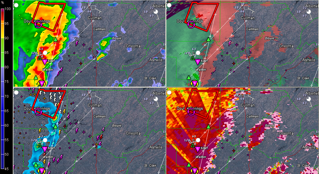
Strong rotation northwest of Arley.
Bryan Falls says his contact in the Sherriff’s office in Winston County is reporting trees and power lines down.
The NWS Huntsville is also issuing a tornado warning for Lawrence and Morgan Counties.
This storm will eventually impact Decatur and Hunstville.
Storms entering the Birmingham Metro are not severe at this point but are moving into more unstable air.
Storms have developed along I-459 across the southern part of the Metro.
Bigger storms extend from Wetumpka northward all the way into Talladega County. Those storms are intensifying and are of concern for us. Plenty of bulk shear and low level helicity.
Going to be a long rest of the afternoon.
THE NATIONAL WEATHER SERVICE IN BIRMINGHAM HAS ISSUED A
* TORNADO WARNING FOR…
NORTHEASTERN WINSTON COUNTY IN NORTHWEST ALABAMA…
* UNTIL 345 PM CDT
* AT 316 PM CDT…THE NATIONAL WEATHER SERVICE INDICATED A SEVERE
THUNDERSTORM CAPABLE OF PRODUCING A TORNADO. THIS DANGEROUS STORM
WAS LOCATED NEAR CORINTH REC AREA…OR 8 MILES NORTHWEST OF
ARLEY…AND MOVING NORTH AT 40 MPH.
* LOCATIONS IMPACTED INCLUDE…
ADDISON…MORELAND…INMANFIELD…BRUSHY LAKE…GRAYSON AND UPSHAW.
PRECAUTIONARY/PREPAREDNESS ACTIONS…
TAKE COVER NOW. FOR YOUR PROTECTION MOVE TO AN INTERIOR ROOM ON THE
LOWEST FLOOR OF A STURDY BUILDING.
Category: Alabama's Weather, Severe Weather
About the Author (Author Profile)
Subscribe
If you enjoyed this article, subscribe to receive more just like it.


