Short Term Forecast
Brian will be along with the map discussion shortly.
Rain has thrown a kink into the plans of many Central Alabamians on this April Sunday.
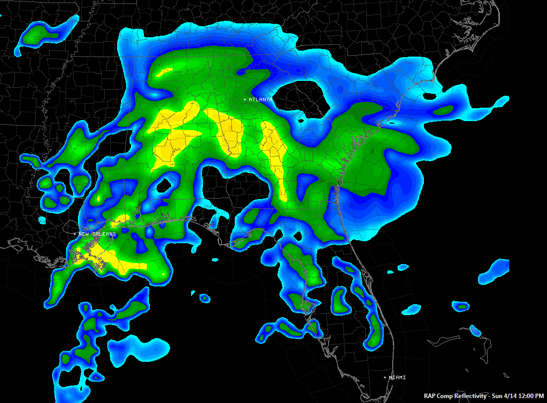
Above you can see a picture of composite reflectivity forecast from the RAP model for noon today. This is an idea of where the rain might be falling. Imagine this moving from southwest to northeast and you get the picture.
As folks head out the door for church, moderate to heavy rain is falling across much of Sumter and parts of Greene, Hale, Perry and Dallas Counties. There is also moderate rain from the Montgomery area east through Union Springs over to Eufaula.
A few spotty showers are over southern Talladega, Tallapoosa and Chambers Counties in East Central Alabama.
Everything is pushing northeast, but the northern edge is having a hard time chewing through dry air the further it makes it.
Light showers will reach Tuscaloosa by 8:30 or so.
Spotty showers will affect areas from Pell City to Birmingham before 9, increasing in intensity and coverage during the late morning.
Rain will become heavier and more widespread generally from eastern Tuscaloosa through southern Jefferson into St Clair and Calhoun counties south into South Central Alabama before noon. Folks in places like Linden, Demopolis, Marion, Selma, Centreville, Clanton, Prattville, Talladega, Columbiana, Pell City, Anniston and Ashland will have scattered showers, with a period or two or moderate rain that could last an hour or two.
In the Birmingham area, it looks like the best chance for moderate to heavy rain will be between 11-2, especially for southern Jefferson, Shelby and St. Clair Counties.
Scattered showers will affect areas north of I-20 later this morning, continuing through much of the day, but rainfall amounts will be light.
There could be some thunder for areas south of US-80, but lightning is confined to southern Mississippi and Louisiana right now. There have been tornado warnings for some of the Louisiana coastal parishes and there is a severe thunderstorm warning right now for St. Bernard Parish east of New Orleans. Severe weather is not expected in Alabama today.
Category: Alabama's Weather
About the Author (Author Profile)
Bill Murray is the President of The Weather Factory. He is the site's official weather historian and a weekend forecaster. He also anchors the site's severe weather coverage. Bill Murray is the proud holder of National Weather Association Digital Seal #0001 @wxhistorianSubscribe
If you enjoyed this article, subscribe to receive more just like it.


