Rain At Times Over The Weekend
**No afternoon Weather Xtreme video today**
RAIN TO THE WEST: While we have enjoyed a delightful day with lots of sun and temperatures in the upper 70s this afternoon, rain and storms are over North Mississippi, and that rain mass is close to the northwest corner of Alabama this afternoon. Clouds increase this evening, and a few showers are possible tonight, mainly over the northern quarter of the state.
TOMORROW: No doubt showers are possible tomorrow, but the latest high resolution NAM still doesn’t show much rain over the state during the day… Below is the NAM output valid at 3pm CT tomorrow…
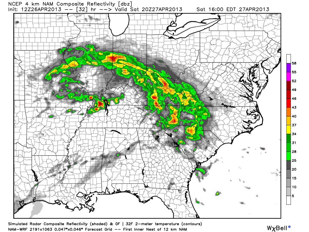
So, hopefully for outdoor events tomorrow rain won’t be too much of a problem, but again we stress a few showers are possible at just about any time. The high will be in the mid to upper 70s, and the sky will be generally cloudy. A strong storm could pop in a few places, but severe weather is not expected. SPC maintains the standard “slight risk” of severe weather tomorrow for much of North Mississippi, where dynamic support is better.
Rain and storms should increase tomorrow night, especially over the northern third of the state. The southern counties of Alabama will get away with just a few scattered showers.
SUNDAY: Occasional showers are likely Sunday, along with a thunderstorm in spots. But, it won’t rain all day. Just be aware some rain will be possible at just about any time Sunday… the high will be in the mid to upper 70s.
NEXT WEEK: Scattered showers will remain possible Monday through Wednesday… but the rain won’t be especially widespread. The weather will be warm and humid with a high around 80 each day… intervals of sun are possible.
MAJOR MAY COLD SNAP: Growers need to pay attention to this. The 12Z GFS confirms the idea of a very deep upper trough forming over the eastern U.S. late next week, with potential for record lows, and the threat of frost or a freeze for North/Central Alabama by Friday and Saturday morning.. May 3/4.
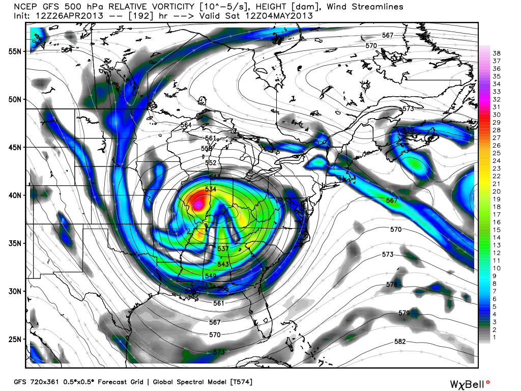
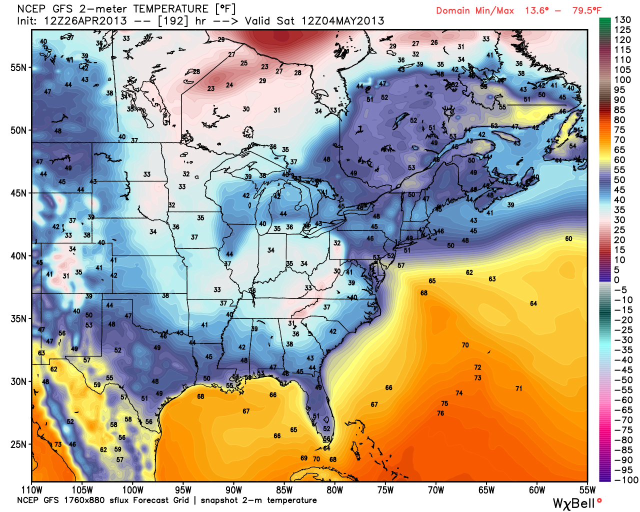
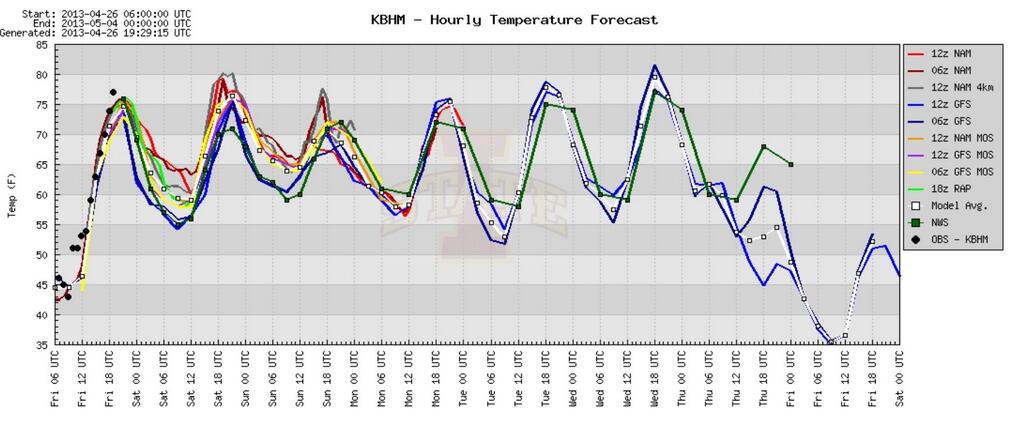
Way too early to be really specific… but it sure looks like we are headed for the 30s either Friday morning (May 3), or Saturday morning (May 4)… or both. That weekend looks very cool and dry. Growers need to pay very close attention… Birmingham has never experienced a freeze later than April 23… this is amazingly cold air for so late in the season. See model temperature projections below…
WEATHER BRAINS: Don’t forget you can listen to our weekly 90 minute netcast anytime on the web, or on iTunes. This is the show all about weather featuring many familiar voices, including our meteorologists here at ABC 33/40.
CONNECT: You can find me on all of the major social networks…
Facebook
Twitter
Google Plus
Instagram
I had a great time today seeing the first graders at Montevallo Elementary… be looking for them on the Pepsi KIDCAM on ABC 33/40 News at 5:00 today. Brian Peters will have the video updates tomorrow and Sunday… my next Weather Xtreme video will be posted bright and early Monday morning by 7:00 a.m. Enjoy the weekend!
Category: Alabama's Weather
About the Author (Author Profile)
James Spann is one of the most recognized and trusted television meteorologists in the industry. He holds the AMS CCM designation and television seals from the AMS and NWA. He is a past winner of the Broadcast Meteorologist of the Year from both professional organizations.Subscribe
If you enjoyed this article, subscribe to receive more just like it.


