

Showers and Storms Increasing, But Not Severe
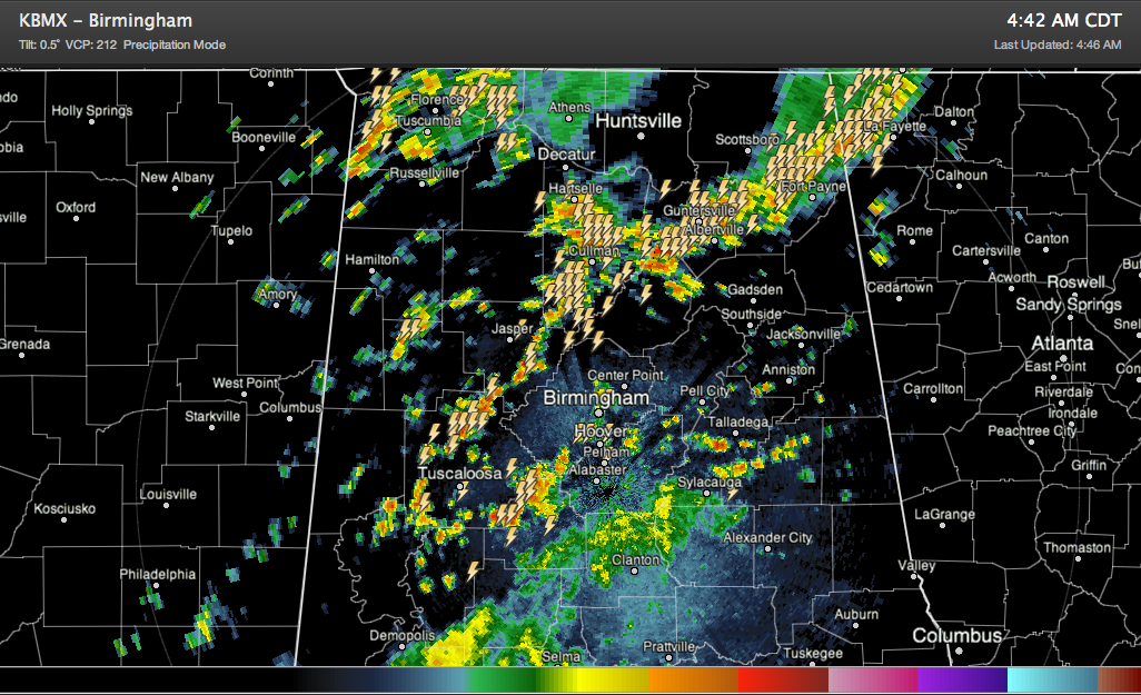
Showers and storms have increased dramatically in coverage early this morning, as expected.
But the good news is that they are not severe, and it doesn’t look like they are likely to, as there is just marginal instability and marginal wind shear in pockets across the area. They have lots of lightning and brief heavy rain in them, and could produce some gusty winds and small hail. So mainly they are just scary sounding, but their bark is worse than their bite.
Having said that, we still can’t rule out an isolated severe storm or two through the morning in areas along and north of I-20, and elsewhere through the afternoon and evening, but there won’t be organized severe weather problems.
There is a surface low in western Kentucky early this morning, with a cold front trailing into northern Mississippi. The storms are forming ahead of a cold front in the relatively warm, moist air to the south of a warm front over northeastern Alabama.
They will continue to develop until the cold front moves through this evening. It fact, the front may not move through as much as it may just fizzle out.
FUNNY NOTE FROM JACKSON MS
The automated sensor at the Airport in Jackson just spit out a wind gust of 58 knots (67 mph). The NWS’s Chad Entremont wrote: Ignore that wind report…must be a bird on the sensor …when the 10z ob comes out, it will have a peak wind of 73kts, ignore that too.
Folks, this is why we still have to have people in the weather process.
Category: Alabama's Weather, Severe Weather
About the Author (Author Profile)
Bill Murray is the President of The Weather Factory. He is the site's official weather historian and a weekend forecaster. He also anchors the site's severe weather coverage. Bill Murray is the proud holder of National Weather Association Digital Seal #0001 @wxhistorianSubscribe
If you enjoyed this article, subscribe to receive more just like it.


