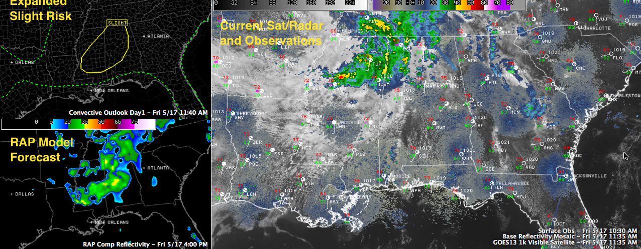
Late Morning Update: Slight Risk Area Expanded
An area of showers and storms continues to move into Northwest Alabama from Mississippi late this morning as an upper low over southeastern Missouri moves slowly eastward.
Most of the lightning is over Central Mississippi, near Grenada, where instabilities are higher.
The precipitation has been weakening as it moved into slightly drier and more stable air over Alabama and further away from that upper low, but that trend will reverse as sunshine south of the I-59 corridor allows the atmosphere to heat up and destabilize.
Those heavier showers and storms over Central Mississippi now will move into western Alabama this afternoon and increase in coverage and intensity as they work into the more unstable air and the upper low moves eastward too.
Some of them could be strong to severe, mainly over northwestern sections. The SPC has just updated their day one severe weather outlook and they have expanded their slight risk area to include a larger area of Alabama. Generally, the northwestern half of the state is now included in the standard risk area. Communities like Birmingham, Huntsville, Gadsden, Cullman, Jasper, Hamilton, Fayette, Tuscaloosa, Centreville, Greensboro, Clanton, Selma and down to Clanton are in the new slight risk.
The main threat will be damaging winds and hail, with locations northwest of I-59 seeing about a 15% chance of a wind or large hail event occurring within 25 miles of them this afternoon and tonight. There is a 2% tornado probability posted, which is very low, but not out of the question.
Areas south of the slight risk area have a 5-15% chance.
Category: Alabama's Weather, Severe Weather
About the Author (Author Profile)
Bill Murray is the President of The Weather Factory. He is the site's official weather historian and a weekend forecaster. He also anchors the site's severe weather coverage. Bill Murray is the proud holder of National Weather Association Digital Seal #0001 @wxhistorianSubscribe
If you enjoyed this article, subscribe to receive more just like it.


