

Isolated Tornadoes Over North Alabama
**No afternoon Weather Xtreme video today due to ongoing weather**
ACTIVE AFTERNOON: Seems like the tornadoes are forming in a zone of high low level bulk shear (0-1 km)…

Some tornado damage was reported near Athens…. many images like this were sent to us around 2:30…

Radar shows considerable shower/storm activity across the northern half of the state at mid-afternoon…

Occasional showers and storms are likely through tonight; a few isolated tornadoes are still possible, especially north of I-20 where bulk shear values are higher. Storms will die down late tonight, after midnight.
THE ALABAMA WEEKEND: A few scattered showers and storms remain possible tomorrow, but they won’t be as widespread as what we are dealing with now. Below is the high resolution NAM valid at 6pm CT
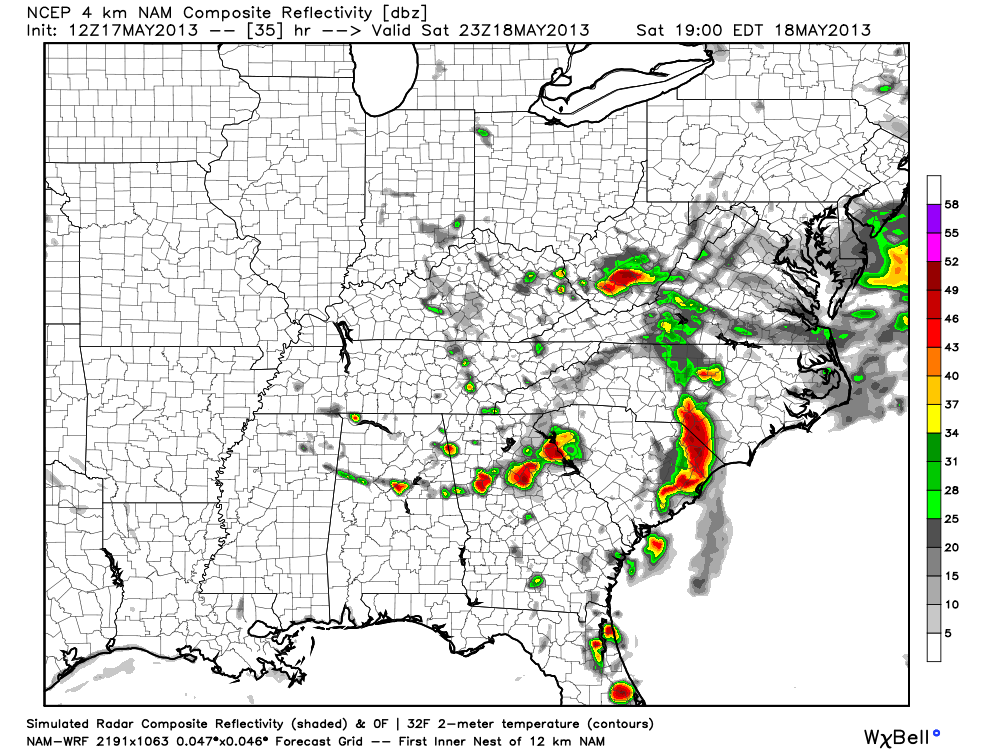
As you can see, the showers and storms tomorrow afternoon will be pretty widely spaced, and we should see some decent intervals of sunshine during the day. The high will be in the low to mid 80s.
Sunday should feature a good supply of sunshine, and while we can’t rule out a shower or storm, most places will be dry with a high around 87 degrees.
NEXT WEEK: Monday and Tuesday look rain-free with a high between 87 and 90 degrees. A few showers could show up by Wednesday and Thursday, but they will be scattered. See the morning Weather Xtreme video for more details….
CONNECT: You can find me on all of the major social networks…
Facebook
Twitter
Google Plus
Instagram
WEATHER BRAINS: Don’t forget you can listen to our weekly 90 minute netcast anytime on the web, or on iTunes. This is the show all about weather featuring many familiar voices, including our meteorologists here at ABC 33/40.
I had a great time today visiting the kids at Saks Elementary School… be looking for them on the Pepsi KIDCAM today at 5:00 on ABC 33/40 News! Brian Peters will have the video updates tomorrow and Sunday… my next video will be up by Monday morning at 7:00 a.m. Enjoy the weekend!
Category: Alabama's Weather
About the Author (Author Profile)
James Spann is one of the most recognized and trusted television meteorologists in the industry. He holds the AMS CCM designation and television seals from the AMS and NWA. He is a past winner of the Broadcast Meteorologist of the Year from both professional organizations.Subscribe
If you enjoyed this article, subscribe to receive more just like it.


