Watching The Gulf…
**No Weather Xtreme video this afternoon… busy preparing for tonight’s two hour WeatherBrains special on the Oklahoma City severe weather situation this past Friday night… we will get back to the “two a day” schedule tomorrow**
RADAR CHECK: As expected, drier air covers the northern half of Alabama this afternoon; showers and storms are very widely spaced over the southern counties of Alabama, generally south of a line from Monroeville to Montgomery to Opelika. Some of the heavier storms at mid-afternoon were in the Phenix City/Columbus, GA area; those are packing lots of lighting and heavy rain. Temperatures are mostly in the mid 80s, and dewpoints around here are mostly in the low 60s.
TOMORROW: The weather over most of Alabama will be dry, with only a few isolated showers over the southern quarter of the state. The day will be warm with a high in the upper 80s.
WEDNESDAY THROUGH FRIDAY: Moisture levels rise, and an afternoon shower or storm could pop up in a few spots by Wednesday afternoon. Then, we will mention scattered showers and storms both Thursday and Friday with a deep layer of moisture in place. The rain won’t be continuous, and the sun will be out at times, but just be ready for a passing shower or storm at just about any time, especially during the afternoon and evening hours. Highs will remain between 85 and 89 degrees for most communities.
IN THE GULF: “Invest 91L” in the southern Gulf is moving to the north/northeast, and has a low chance of becoming a tropical depression…
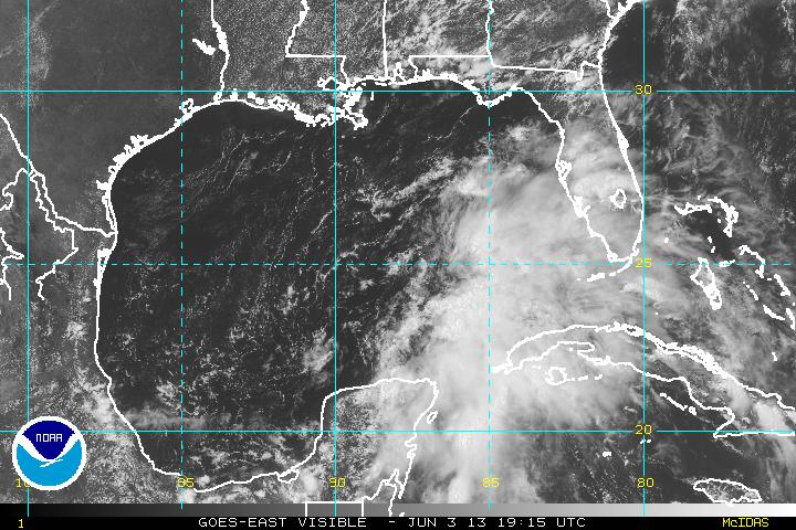
Models want to bring it now up toward the Florida panhandle…
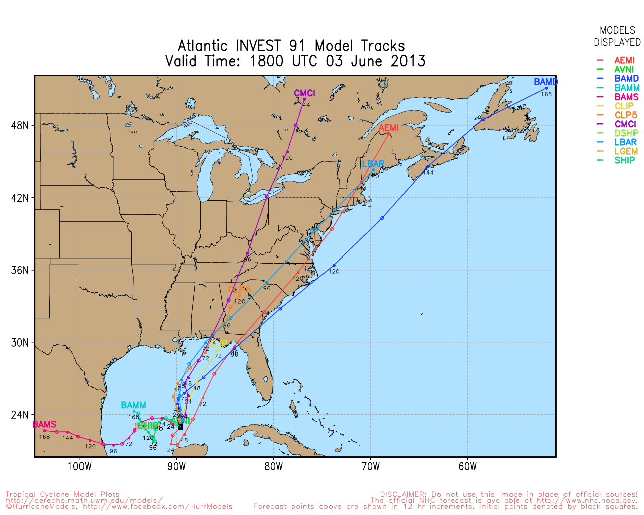
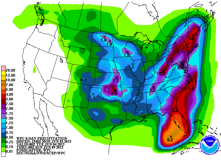
Not sure it is able to develop into a depression, but the main impact one way or another will be heavy rain for the Florida peninsula…
THE ALABAMA WEEKEND: The GFS continues to show drier air dropping into the state with few, if any, showers around here Saturday and Sunday. Highs will remain in the 80s.
AT THE BEACH: About 6 to 8 hours of sunshine each day on the Gulf Coast from Panama City west to Gulf Shores; each day a few scattered showers and storms are possible. Chance of any one spot getting wet is about 30 percent on a daily basis through Sunday; the organized rain with the disturbance in the Gulf should stay south. Highs will be in the 80s, and the sea water temperatures are generally around 80 degrees.
WEATHER BRAINS: Don’t forget you can listen to our weekly 90 minute netcast anytime on the web, or on iTunes. This is the show all about weather featuring many familiar voices, including our meteorologists here at ABC 33/40. We have a two hour special tonight… beginning at 8:00 p.m. CT as we look back the the tragic death of three storm chasers in Oklahoma City this past Friday night. You can watch on our digital weather channel called “James Spann 24/7” on cable systems around the state, or online in the post below this one.
CONNECT: You can find me on all of the major social networks…
Facebook
Twitter
Google Plus
Instagram
Look for the next Weather Xtreme video here by 7:00 a.m. tomorrow….
Category: Alabama's Weather
About the Author (Author Profile)
James Spann is one of the most recognized and trusted television meteorologists in the industry. He holds the AMS CCM designation and television seals from the AMS and NWA. He is a past winner of the Broadcast Meteorologist of the Year from both professional organizations.Subscribe
If you enjoyed this article, subscribe to receive more just like it.


