Strong Storms Over West Alabama
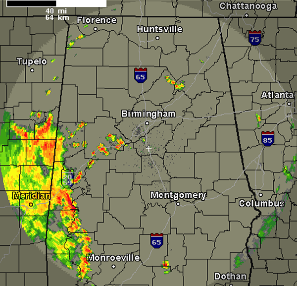
Strong storms have moved in from Mississippi this afternoon and some have developed over West Alabama as well. Though none of these storms are currently severe, the are producing frequent lightning, torrential rain, maybe some small hail and gusty winds. Like yesterday, the main concern with these storms today will be a threat for flash flooding.
The most intense activity is confined to West Alabama currently. Storms are impacting areas from Tuscaloosa and Pickens Counties down through Clarke County. Interstate 20/59 and highways 11, 43, 69, 25, 82 and 80 are going to be impacted be these storms. Some areas that are seeing and should see these storms are Vance, Moundville, Greensboro, Livingston, Eutaw, Dayton, Demopolis and Reform. These storms should last for the next few hours and could last into the overnight hours.
Category: Alabama's Weather
About the Author (Author Profile)
Macon, Georgia Television Chief Meteorologist, Birmingham native, and long time Contributor on AlabamaWX. Stormchaser. I did not choose Weather, it chose Me. College Football Fanatic. @Ryan_StinnetSubscribe
If you enjoyed this article, subscribe to receive more just like it.


