Mid-Morning Radar Check
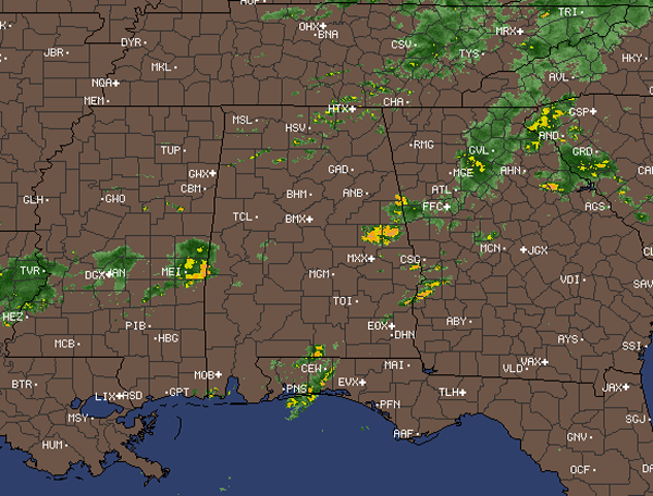
A quick look around the region shows showers and thunderstorms are once again impacting the state today. Some of the more intense showers are in Sumter, Tallapoosa and Chambers Counties. Most of this activity continues to slide off to the east this morning.
The last few radar scans are now showing additional showers and thunderstorms developing from near Chattanooga, southwest across the Tennessee Valley into northern Mississippi. This activity will continue to develop through out the morning and will be impacting central Alabama. The rest of today should be very similar to what we saw Monday. Widespread showers and thunderstorms, some of which could be strong. We may even see a few briefly isolated severe storms that could be capable of producing damaging winds and some hail. All storms today will have intense rainfall, frequent lightning and gusty winds. Conditions across the state will finally begin to improve later this evening and into the overnight hours as a frontal boundary will push off to our south.
Category: Alabama's Weather
About the Author (Author Profile)
Macon, Georgia Television Chief Meteorologist, Birmingham native, and long time Contributor on AlabamaWX. Stormchaser. I did not choose Weather, it chose Me. College Football Fanatic. @Ryan_StinnetSubscribe
If you enjoyed this article, subscribe to receive more just like it.


