

Forecast on Track
Central Alabama…
The diffuse boundary that has been the focus for showers and thunderstorms for the last several days has shifted a bit further south, so the forecast of shower-free weather for Central Alabama appears to be on track. Temperatures were well into the middle 80s thanks to a plenty of sunshine. Some cumulus clouds had formed, but those are expected to dissipate shortly after sunset this evening. The really good news was that dew points had fallen to the upper 50s in the Tennessee Valley and into the middle 60s in Central Alabama. This is not much of a change, but it is just enough to make it feel a tad less hot outside.
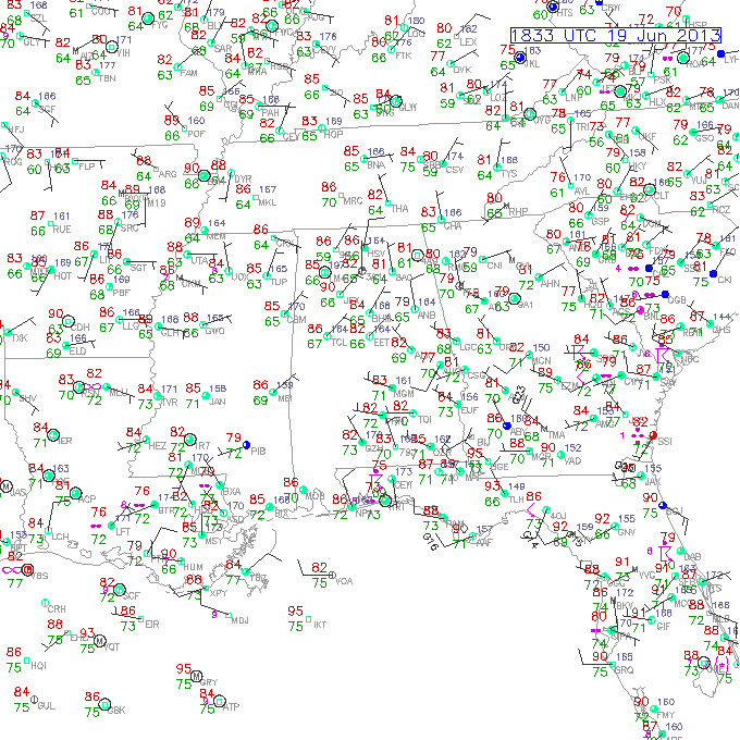
Southeast US Weather Observations
Radar showed a band of showers mainly across South Alabama from roughly Eufaula on the Georgia line to Chatom on the Mississippi line and from Montgomery southward. Not quite as many showers in the Florida Panhandle as I thought we might see.
Tropics…
Still watching TD 2 in the Bay of Campeche. Satellite imagery showed a nice flare up of convection just offshore close to where the center of the depression should be. A reconnaissance aircraft was to investigate the area and should be in that vicinity now. So far, though, I have not seen any reconnaissance reports as to what kind of wind speed they may have found. The depression continued to move westward and will move back over the coastline early Thursday. It’s going to be close as to whether it will achieve tropical storm status before reaching the coast.
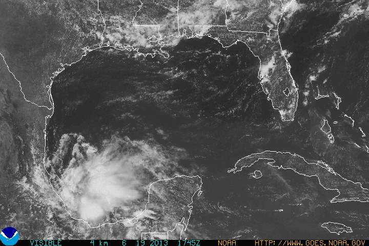
TD 2 Wed at 1 pm
-Brian-
Category: Alabama's Weather
About the Author (Author Profile)
Brian Peters is one of the television meteorologists at ABC3340 in Birmingham and a retired NWS Warning Coordination Meteorologist. He handles the weekend Weather Xtreme Videos and forecast discussion and is the Webmaster for the popular WeatherBrains podcast.Subscribe
If you enjoyed this article, subscribe to receive more just like it.


