Soaking Showers and Storms
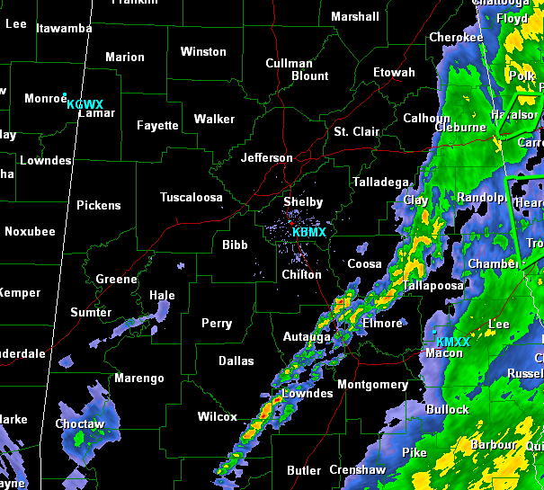
A quick look at the radar this midday continues to show Gulf moisture surging north across the state. The heaviest rainfall continues to fall across eastern portions of the state, but we are now seeing development in central areas of the state between Birmingham and Montgomery. The bulk of the activity will be lifting to the north through out the afternoon. The wet weather will stick around for the next few days and we are all in store for a wet Fourth of July Holiday.
Don’t forget a flash flood watch will go into effect this evening at 7PM. Currently that watch will include all counties along Interstate 65 and east to the Georgia state line. Heavy tropical rains will continue to saturate Alabama over the next 48 hours and rainfall totals can be anywhere from 2-5 inches. The heavier totals should remain on the east side of state. This watch could be expanded and we could also see flash flood warnings issued anywhere across the area.
Category: Alabama's Weather
About the Author (Author Profile)
Macon, Georgia Television Chief Meteorologist, Birmingham native, and long time Contributor on AlabamaWX. Stormchaser. I did not choose Weather, it chose Me. College Football Fanatic. @Ryan_StinnetSubscribe
If you enjoyed this article, subscribe to receive more just like it.


