Latest on Chantal
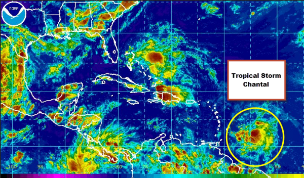
The National Hurricane Center continues to track Tropical Storm Chantal this evening. She has strengthened ever so slightly through out the day and here are the latest details from the NHC.
…RECONNAISSANCE AIRCRAFT FINDS CHANTAL A LITTLE STRONGER…
SUMMARY OF 800 PM AST…0000 UTC…INFORMATION
———————————————-
LOCATION…11.8N 55.0W
ABOUT 320 MI…515 KM ESE OF BARBADOS
MAXIMUM SUSTAINED WINDS…50 MPH…85 KM/H
PRESENT MOVEMENT…WNW OR 285 DEGREES AT 26 MPH…43 KM/H
MINIMUM CENTRAL PRESSURE…1010 MB…29.82 INCHES
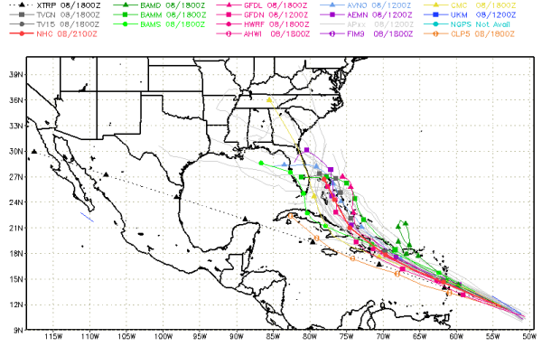
As we look at where she is heading, this image shows all the different and latest model runs on Chantal. She is expected to affect the Lesser Antilles before continuing a track to the northwest across the Greater Antilles. She is expected to cross Hispaniola and emerge over the Turks and Caicos and Bahamas later this week. We still have plenty of time to watch this, but some of the models are suggesting that once Chantal makes it to the east coast of Florida, she could turn west and cross the peninsula and perhaps affect the Gulf Coast. It certainly could bring heavier rain back into the Southeast by the end of the weekend.
Category: Tropical
About the Author (Author Profile)
Macon, Georgia Television Chief Meteorologist, Birmingham native, and long time Contributor on AlabamaWX. Stormchaser. I did not choose Weather, it chose Me. College Football Fanatic. @Ryan_StinnetSubscribe
If you enjoyed this article, subscribe to receive more just like it.


