

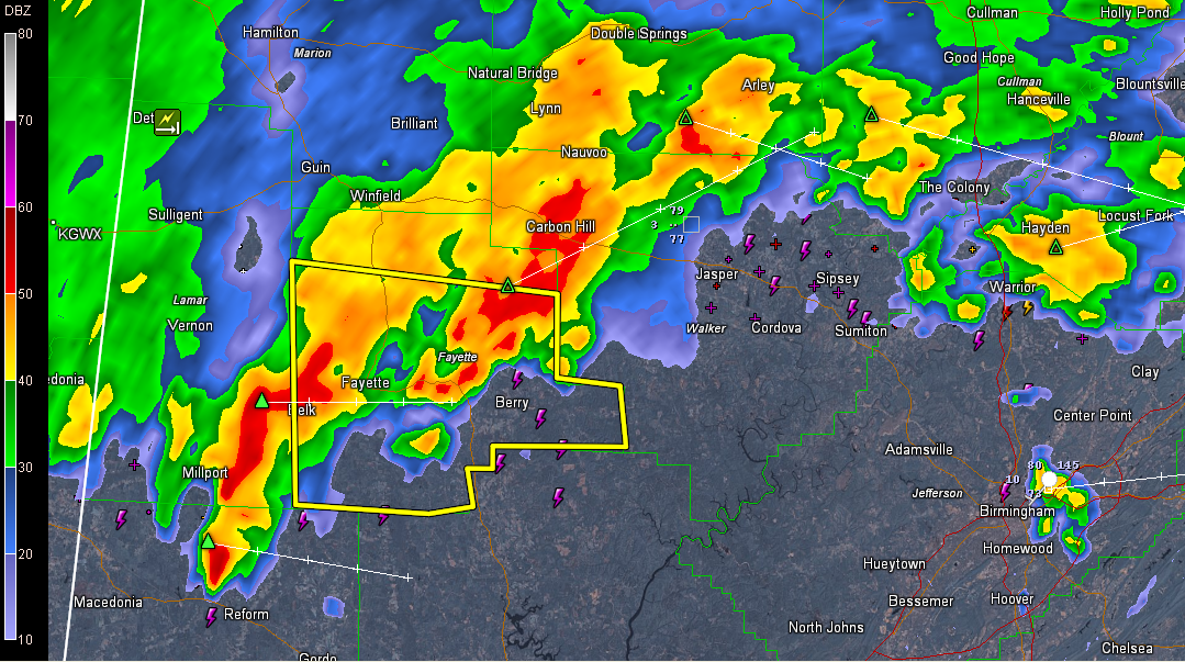
Severe Thunderstorm Warning Fayette County til 1PM

UPDATE: Damaging winds are the main threat with this storms. Numerous reports of trees down in Marion and Lamar Counties. This intense complex of storms continues to head towards the Birmingham metro. The most intense storms are located across southern Lamar, Fayette, Walker and Winston Counties. Rough weather will be impacting Jasper around 12:30, Birmingham about 1:30, but the northwest suburbs will see these storms beforehand.
Reports of several trees down in northern Lamar County. The thunderstorms that produced that damage are now moving across Fayette County.
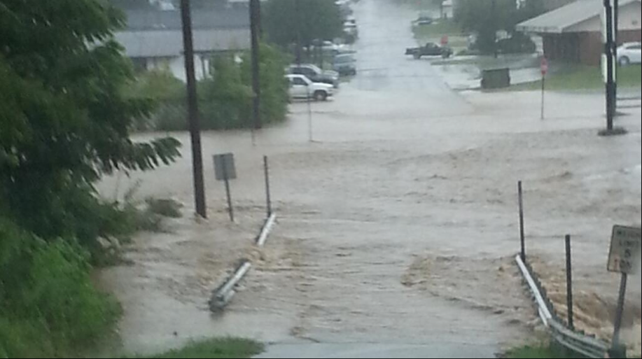
Flooding is severe in and around the Russellville area in Franklin County. Here is an image from @tidefan319:
THE NATIONAL WEATHER SERVICE IN BIRMINGHAM HAS ISSUED A
* SEVERE THUNDERSTORM WARNING FOR…
FAYETTE COUNTY IN WEST CENTRAL ALABAMA…
* UNTIL 100 PM CDT
* AT 1215 PM CDT…THE NATIONAL WEATHER SERVICE INDICATED A SEVERE
THUNDERSTORM CAPABLE OF PRODUCING DAMAGING WINDS IN EXCESS OF 60
MPH. THIS STORM WAS LOCATED NEAR BELK…OR NEAR FAYETTE…AND
MOVING SOUTHEAST AT 25 MPH.
* LOCATIONS IMPACTED INCLUDE…
FAYETTE…ASHCRAFT CORNER…BANKSTON…BERRY…BOLEY SPRINGS…
BEVILL STATE COLLEGE FAYETTE…RICHARD ARTHUR FIELD AND
HUBBERTVILLE.
WINDS OF 60 TO 70 MPH WILL BREAK LARGE TREE LIMBS AND CAUSE SOME
DAMAGE…ESPECIALLY TO SMALLER STRUCTURES.
PRECAUTIONARY/PREPAREDNESS ACTIONS…
FOR YOUR PROTECTION…MOVE TO AN INTERIOR ROOM ON THE LOWEST FLOOR OF
YOUR HOME OR BUSINESS.
Category: Alabama's Weather, Severe Weather
About the Author (Author Profile)
Subscribe
If you enjoyed this article, subscribe to receive more just like it.


