Dorian Dissipates Again
The National Hurricane Center has issued the last advisory on Dorian. Yesterday, the remnants of Dorian re-organized, exhibited tropical characteristics and were upgraded to a tropical depression. Intensification was not expected as a the system would be impacted by a higher shear environment today. That did in fact happen and took a toll on the system causing the system to become unorganized and weaken.
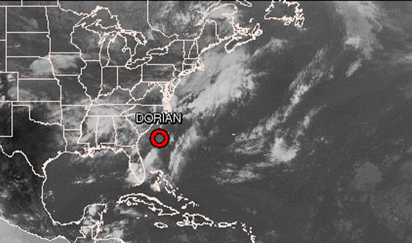
Here is the official advisory from the National Hurricane Center.
…DORIAN NO LONGER A TROPICAL CYCLONE…
SUMMARY OF 500 PM EDT…2100 UTC…INFORMATION
———————————————-
LOCATION…31.7N 77.6W
ABOUT 160 MI…255 KM ESE OF CHARLESTON SOUTH CAROLINA
MAXIMUM SUSTAINED WINDS…30 MPH…45 KM/H
PRESENT MOVEMENT…NE OR 45 DEGREES AT 16 MPH…26 KM/H
MINIMUM CENTRAL PRESSURE…1013 MB…29.91 INCHES
WATCHES AND WARNINGS
——————–
THERE ARE NO COASTAL WATCHES OR WARNINGS IN EFFECT.
DISCUSSION AND 48-HOUR OUTLOOK
——————————
AT 500 PM EDT…2100 UTC…THE CENTER OF POST-TROPICAL CYCLONE
DORIAN WAS LOCATED NEAR LATITUDE 31.7 NORTH…LONGITUDE 77.6 WEST.
THE POST-TROPICAL CYCLONE IS MOVING TOWARD THE NORTHEAST NEAR 16 MPH
…26 KM/H. THIS GENERAL MOTION IS EXPECTED TO CONTINUE DURING THE
NEXT 12 HOURS.
MAXIMUM SUSTAINED WINDS ARE NEAR 30 MPH…45 KM/H…WITH HIGHER
GUSTS. THE POST-TROPICAL CYCLONE IS EXPECTED TO DISSIPATE EARLY
SUNDAY.
THE ESTIMATED MINIMUM CENTRAL PRESSURE IS 1013 MB…29.91 INCHES.
HAZARDS AFFECTING LAND
———————-
NONE.
NEXT ADVISORY
————-
THIS IS THE LAST PUBLIC ADVISORY ISSUED BY THE NATIONAL HURRICANE
CENTER ON THIS SYSTEM. ADDITIONAL INFORMATION ON THIS SYSTEM CAN BE
FOUND IN HIGH SEAS FORECASTS ISSUED BY THE NATIONAL WEATHER
SERVICE…UNDER AWIPS HEADER NFDHSFAT1 AND WMO HEADER FZNT01 KWBC
Category: Tropical
About the Author (Author Profile)
Macon, Georgia Television Chief Meteorologist, Birmingham native, and long time Contributor on AlabamaWX. Stormchaser. I did not choose Weather, it chose Me. College Football Fanatic. @Ryan_StinnetSubscribe
If you enjoyed this article, subscribe to receive more just like it.


