Severe Weather Outbreak in Plains
LATE REPORT
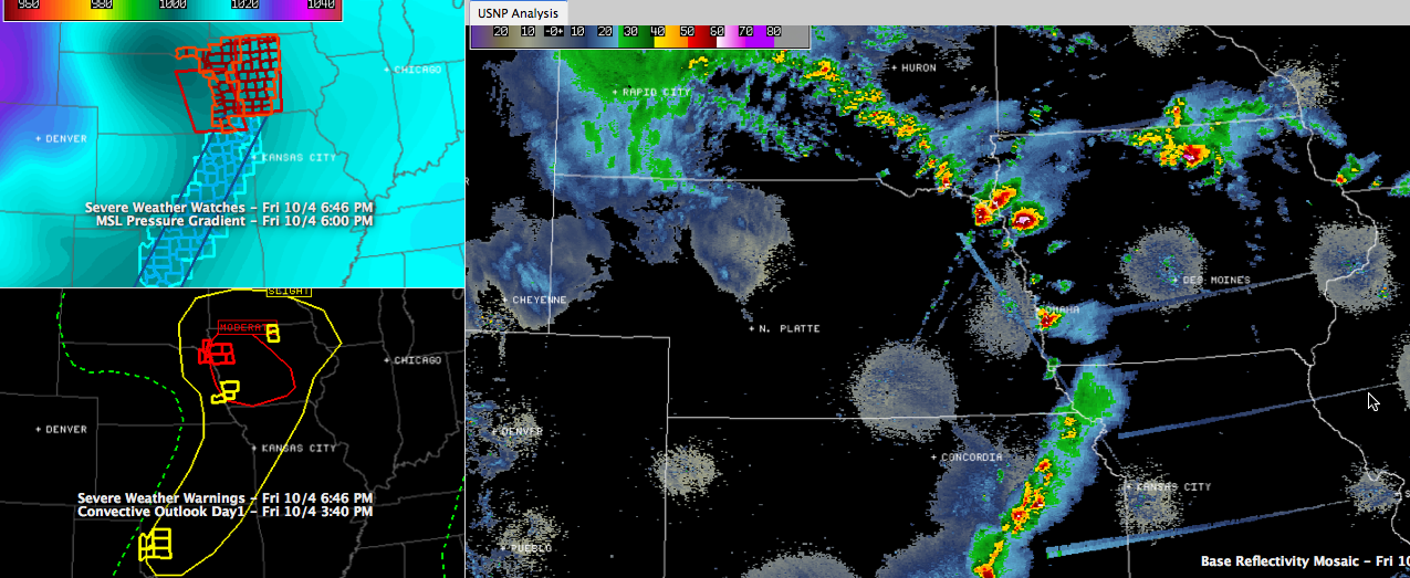
from Jeff Kc5gla (via spotternetwork.org) @ 6:57 PM CDT — (S) Tor — — Spotter is 2 miles E of MOVILLE, IA (Woodbury county) [42.482/-96.022] — Mile wide tornado major damage tornado emergency (SN#15359)
ORIGINAL POST
An intense low pressure system over eastern Nebraska is producing numerous supercell thunderstorms, some producing large and damaging tornadoes over northeastern Nebraska and western Iowa.
A 1/2 mile wide tornado was reported at 6:08 near Emerson NE. This tornado was near Jefferson SD at 6:32 and will cross into Iowa. This is north of Sioux City.
Another dangerous storm that has produced numerous reports of tornadoes will be passing over US-20 between Correctionville and Moville east of Sioux City around 7 p.m.
The tornado watch for eastern Nebraska and western Iowa has had to be extended northward to include part of southeastern South Dakota and northwestern Iowa.
There have been 32 severe weather reports in this area today, including 10 tornado reports.
The SPC has had a moderate risk for parts of this area since the Day Two outlook yesterday.
Category: Headlines, Severe Weather
About the Author (Author Profile)
Bill Murray is the President of The Weather Factory. He is the site's official weather historian and a weekend forecaster. He also anchors the site's severe weather coverage. Bill Murray is the proud holder of National Weather Association Digital Seal #0001 @wxhistorianSubscribe
If you enjoyed this article, subscribe to receive more just like it.


