Football Weather Today/Storms Tomorrow Night
Many questions about the Alabama weather situation, so here are some thoughts this Saturday morning.
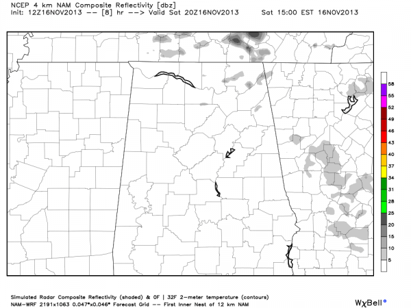
FOOTBALL WEATHER: Not much change in the thinking for the college games today. This afternoon, Auburn hosts Georgia (2:30p CT kickoff), and in Birmingham Samford hosts UT Chattanooga for homecoming (2:00p CT kickoff). For both of these games, the sky will be mostly cloudy, and I can’t rule out a passing shower. But, the day will be generally rain-free. Below is the high resolution NAM valid at 3:00 this afternoon, which basically shows nothing around here.
Afternoon temperatures will be in the 60s.
Pretty much the same setup for tonight’s Alabama/Mississippi State game in Starkville (6:45p CT kickoff). Mostly cloudy; a shower is possible, but not likely.
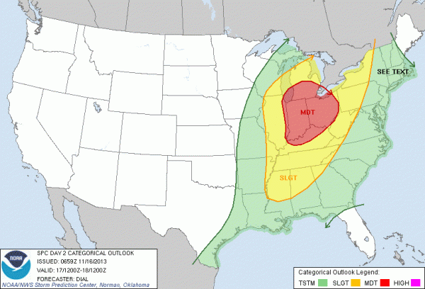
STORMS TOMORROW NIGHT: SPC maintains the standard “slight risk” of severe weather for roughly the northern half of Alabama for late tomorrow and tomorrow night… with a moderate risk to the north.
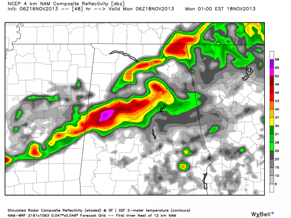
Again, not much change in our overall thinking. A line of strong storms will enter Northwest Alabama around 6:00 tomorrow evening, reaching the Birmingham/Tuscaloosa/Anniston/Gadsden areas toward midnight. Below is the high resolution NAM output valid at midnight tomorrow night.
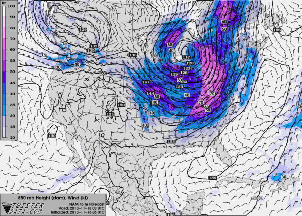
Below is the wind field at 850 mb, or about 5,000 feet, and you can see the low level jet will remain well north of Alabama, along with the best dynamic forcing.
This would suggest that the storms could be at severe limits at they move into Northwest Alabama tomorrow evening, but they should weaken as they move deeper into the state, and our severe weather risk down this way is very marginal.
Still, models have been a little more aggressive with instability levels, showing surface dew points rising into the upper 60s during the day tomorrow, and surface based CAPE values over 750 j/kg. So, we will watch radar trends as the event begins to unfold. We are thankful the main dynamic forcing and stronger wind fields are well to the north.
SPOTTER TRAINING IS ONE WEEK FROM TODAY: Our annual storm spotter training, Storm Alert Xtreme, is Saturday November 23 at 9:00 at the BJCC… we hope to see you there!
Category: Alabama's Weather


