

Arctic Hammer Ahead; South Alabama Snow?
Just trying to stay ahead of the rumor mill this afternoon. High confidence the week ahead will be brutally cold across the eastern half of the nation, including Alabama. Low confidence on a snow threat.
THE COLD: This is the projected 500 mb pattern across North America Tuesday evening (from the GFS model)…
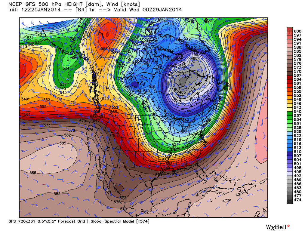
This is big time cold. Chicago might make a run at -30 (F)… below their all time record low. For any month, any year.
HOW LOW WILL IT GO? Here in Alabama, the GFS model is printing a high at Birmingham of 26 on Tuesday, with a low early Wednesday morning of 7 degrees. This could match the low we saw back on January 7. I would not be surprised if models actually trend a few degrees colder in coming days. Our record low for January 29 is 2 degrees, set in 1966, when we had snow on the ground.
SOUTH ALABAMA SNOW? The weather community is buzzing after the 12Z NAM model brings in a southern stream system, with snow over the southern half of Alabama Tuesday.

Yes, the model is suggesting 2 to 4 inches of snow, with the higher amounts for places like Monroeville, Greenville, and Troy. Just a dusting as far north as I-20.
DON’T GET EXCITED YET: The global models (GFS AND ECMWF) are not on the snow bandwagon, however, showing a dry and cold look for the state Tuesday.


With such a deep, cold Arctic airmass, it could seem logical that any weather system in the southern stream would be shunted south of here, well down in the Gulf. So, for now, we are not going to mention snow for South Alabama Tuesday.
HOWEVER: The system yesterday and last night was not handled well by the global models, and it brought freezing rain, sleet, and some snow to Southeast Texas, and the far south part of Louisiana, Mississippi, and Alabama. We will need to watch model trends.
BOTTOM LINE: Plan now for another cold wave. A good chance Birmingham (and much of North Central Alabama) goes below freezing Monday night, and stays below freezing until midday Thursday. Single digit cold is likely at daybreak Wednesday along and north of I-20 again.
GOOD NEWS: The persistent pattern breaks down late the week, and we thaw nicely next weekend. A decent chance we reach the low 60s Saturday. We will have updates here on the blog, so stay tuned…
Category: Alabama's Weather
About the Author (Author Profile)
James Spann is one of the most recognized and trusted television meteorologists in the industry. He holds the AMS CCM designation and television seals from the AMS and NWA. He is a past winner of the Broadcast Meteorologist of the Year from both professional organizations.Subscribe
If you enjoyed this article, subscribe to receive more just like it.


