

Midnight Update
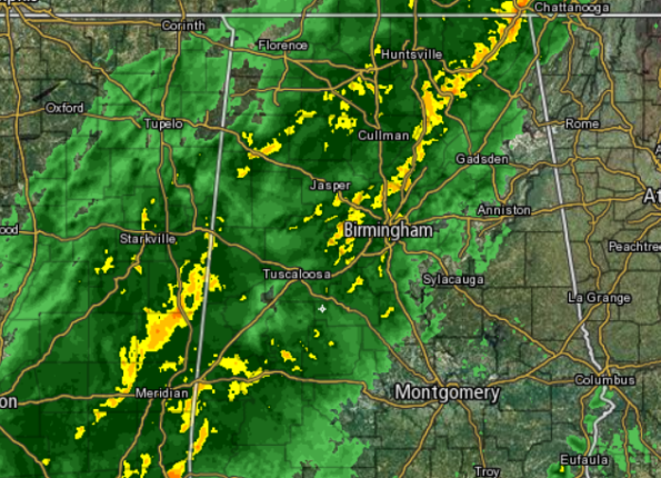
We have made it to a time when there are no active warnings for any part of Central Alabama. The intensity of the storms has wound down the last hour and hopefully we can make it through the rest of the night with no additional warnings needed. We still have several hours of unsettled weather as the frontal boundary is still off to our west. It will be pushing through overnight and will clear us out by tomorrow morning.
A current look at the radar shows much of Central Alabama continues to see showers and thunderstorms. The storms are producing very heavy rainfall, gusty winds, small hail, and frequent lightning. Once again at this time, no storms are currently severe in the area. We will have to monitor rainfall rates the next few hours as we could see some areas prone to flooding develop some issues.
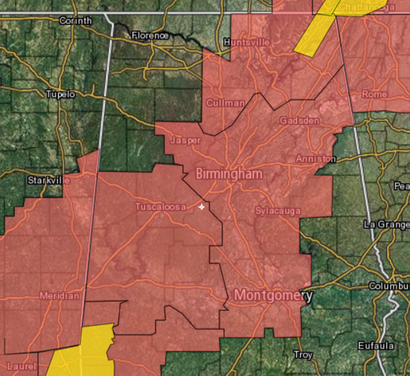
Much of West-Central Alabama remain under a tornado watch until 1 AM. The rest of Central Alabama is under a tornado watch until 3 AM. All counties in pink are in one of these two watches. The areas in yellow are current severe thunderstorm warnings. Note no warnings in Central Alabama and the only warnings in the state are confined to the northeastern and southwestern part of the state. The tornado watches should be allowed to expire on time during the early morning hours.
Category: Alabama's Weather, Severe Weather
About the Author (Author Profile)
Macon, Georgia Television Chief Meteorologist, Birmingham native, and long time Contributor on AlabamaWX. Stormchaser. I did not choose Weather, it chose Me. College Football Fanatic. @Ryan_StinnetSubscribe
If you enjoyed this article, subscribe to receive more just like it.


