

Worst of the Weather Shifting East
Storms have really increased in intensity and coverage this morning. No storms are currently severe, but there are several storms just below severe limits and they are affecting Chambers, Coosa, Elmore, Tallapoosa, and Bullock counties. Storms are racing off to the northeast this morning and are producing torrential rainfall, as well as gusty winds and frequent lightning. Areas to the east of Interstate 65 will be under the gun for the next couple of hours as the storms continue that direction.
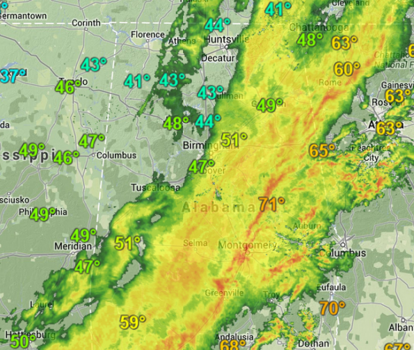
Now that we are seeing the cold front sweep into the state, we are beginning to see improving condition across west-central Alabama. Areas to the west of I-65 are all but done with the storms. There continue to be a few light showers, but nothing to be concerned with. The temperature is actually falling rapidly behind the front and we are seeing those 60s and 70s from earlier, be replaced with 40s.
It has been a busy night across the state as numerous reports of tree and power line damage has occurred across several counties. In Central Alabama the hardest hit areas have been across portions of Walker, Winston, and Fayette counties. A few tornado reports from Limestone, Madison, and DeKalb counties as well with quite a bit of damage.
A reminder that most counties in Central Alabama remain under a severe thunderstorm watch until 8 AM. Of course as the front passes through, counties will be trimmed out of the watch. We should see just a few more hours of unsettled weather.
Category: Alabama's Weather
About the Author (Author Profile)
Macon, Georgia Television Chief Meteorologist, Birmingham native, and long time Contributor on AlabamaWX. Stormchaser. I did not choose Weather, it chose Me. College Football Fanatic. @Ryan_StinnetSubscribe
If you enjoyed this article, subscribe to receive more just like it.


