

A Tale of Two Sky Covers
Click image to enlarge.
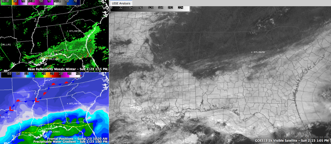
It has been a tale of two sky covers across Alabama on this last Sunday in February. South of a line from Meridian to Montgomery to Phenix City, skies have been mostly cloudy. Rain has been common to the south as well. North of the line, skies have been mostly sunny. The clouds will not make much progress further north, although a few clouds will spread across the area at times. Skies could become briefly cloudy as far north as I-20.
TEMPERATURES: Across the middle of the state at noon along the I-20 corridor, temperatures are in the 70F range. It had officially reached 70F at all three I-20 reporting locations, including 72F at Anniston and 70F at the Tuscaloosa and the Birmingham Airport. In areas where it has been raining steadily, like Evergreen and Dothan, temperatures have remained in the 50s.
TONIGHT THROUGH TUESDAY: A cold front will pass through the area this evening, but it won’t turn substantially colder through Tuesday. Overnight lows will drop into the lower 40s. Clouds will increase late in the day tomorrow ahead of our next system and there could be a little rain tomorrow night. Rain chances will continue through much of Tuesday, with the best chances Tuesday night ahead of an approaching shot of Arctic air. Highs Monday and Tuesday will be in the upper 50s. Lows Monday night will be in the 40s. We will be near freezing Wednesday morning behind a strong cold front. Wednesday will be a blustery day with temperatures hovering in the 30s all day. It now looks like lows Wednesday night will be in the lower and middle 20s.
Category: Alabama's Weather
About the Author (Author Profile)
Bill Murray is the President of The Weather Factory. He is the site's official weather historian and a weekend forecaster. He also anchors the site's severe weather coverage. Bill Murray is the proud holder of National Weather Association Digital Seal #0001 @wxhistorianSubscribe
If you enjoyed this article, subscribe to receive more just like it.


