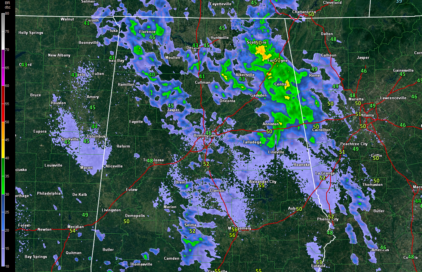
Showers Moving Out to the East
After a pretty nice Friday afternoon across Central Alabama, which saw highs top out near 60F, showers have been moving across the state tonight. Rainfall amounts have been light, generally less than one tenth of an inch. The showers are diminishing and moving to the east late tonight.
Click image to enlarge.
Mild temperatures are in store across the area today, which even nicer readings in store for tomorrow. But even though we turn the page today to March and to meteorological spring, don’t count your chickens just yet. Winter has a few more reminders left that it is officially not out the door until March 22 by the calendar, including some colder weather this week.
With a good supply of sunshine Saturday, temperatures will warm well into the 60s. Highs will generally warm into the middle 60s from US-78/280 northeastward, with upper 60s and even a couple of 70 degree readings possible in places like Livingston and Demopolis. Lows Saturday night will barely make it into the middle and upper 40s.
IF YOU LIKE SATURDAY, YOU WILL LOVE SUNDAY: It doesn’t get much better than the weather we expect Sunday here in Alabama. With a good supply of sunshine under partly cloudy skies, highs will warm into the middle 70s. That’s right, you heard it: 70s. Go outside and roll around in the grass like a puppy! But change will not be far away, even as you are frolicking.
It comes in the form a a big load of heavy, cold air that will be making its way over the border from Canada into the northern and Central Plains. This cold air is behind all of the mischief to our north. By Sunday night, the cold front will be moving into the Northwest part of Alabama. Showers and some thunderstorms will push into the state starting late Sunday afternoon and progressing southeastward through the overnight hours. Rainfall amounts won’t be especially heavy, averaging around one half inch, with some one inch amounts possible.
IMPORTANT HEADS UP IF YOU’RE DRIVING NORTH: It is hard to imagine that while we are talking about 70s here in Alabama, Winter Storm Watches are posted not very far to our north. Places from eastern Kansas and Oklahoma across all of Oklahoma, northern Arkansas, northwestern Tennessee, much of Illinois, Indiana, Ohio and all of Kentucky into western Pennsylvania and West Virginia.
A major, crippling ice storm is expected across much of Kentucky with a quarter of an inch to one half of ice expected to accumulate. To the north, heavy snow is expected. 10-14 inches of snow will fall across North Central Ohio, which 6-8 inches around Cincinnati The snow will fall on top of a thin layer of freezing rain. St. Louis is expecting 5 inches of snow, and around 7-10 inches around Indianapolis. If you are traveling north into these areas starting Saturday night through Monday, please check the latest forecasts and warnings.
Click image to enlarge.
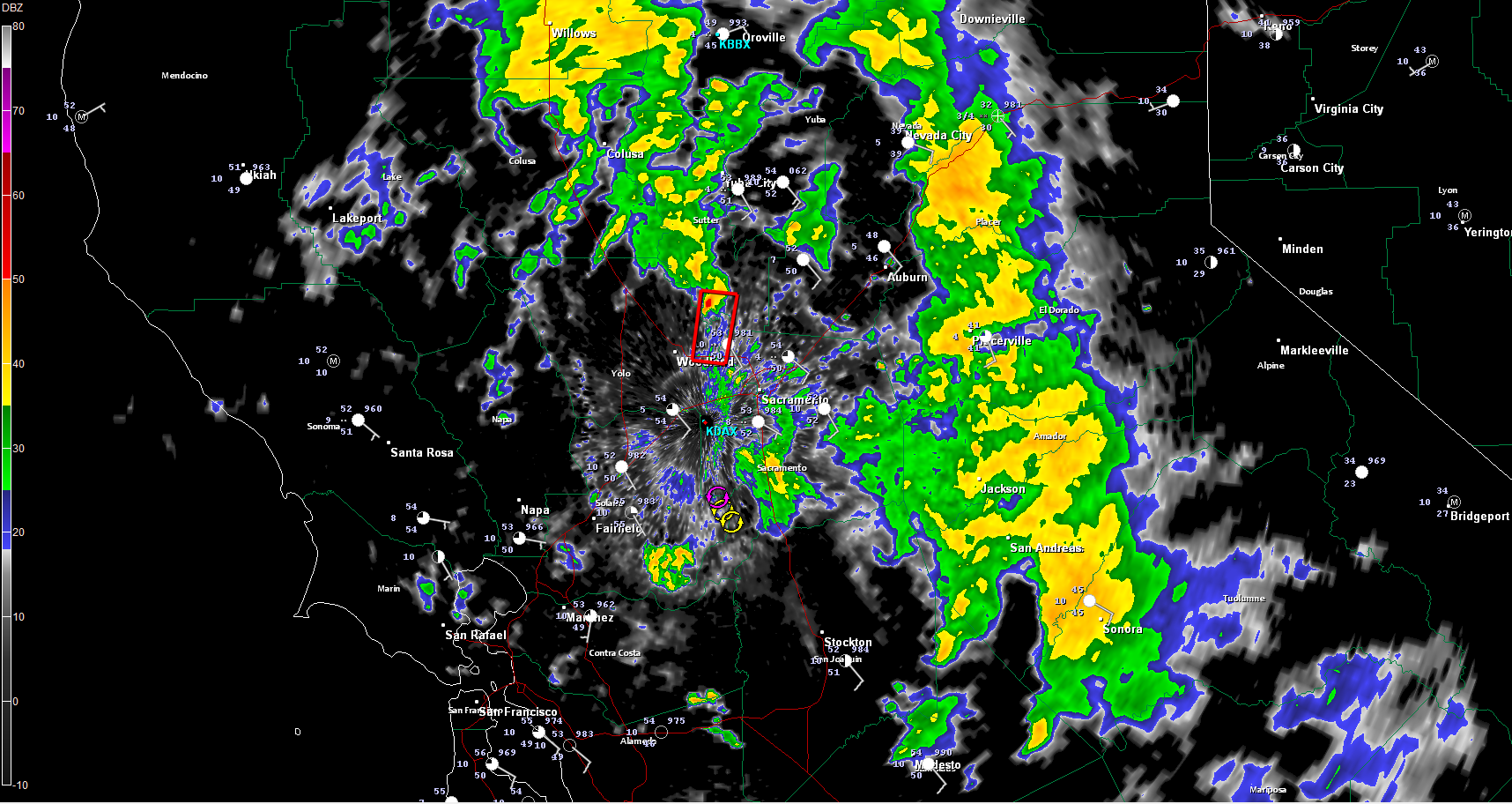
TORNADO WARNING TONIGHT:
The NWS in Sacramento issued a tornado warning tonight about 8:30 p.m. CST for a storm northwest of Sacramento. A funnel cloud and lowering did pass over I-5 near Woodland, but I have not seen any indication that a tornado touched down.
Category: Alabama's Weather, Headlines, Winter Weather
About the Author (Author Profile)
Bill Murray is the President of The Weather Factory. He is the site's official weather historian and a weekend forecaster. He also anchors the site's severe weather coverage. Bill Murray is the proud holder of National Weather Association Digital Seal #0001 @wxhistorianSubscribe
If you enjoyed this article, subscribe to receive more just like it.


